Home » Satellite Images » US States » Louisiana
Satellite Image of Louisiana
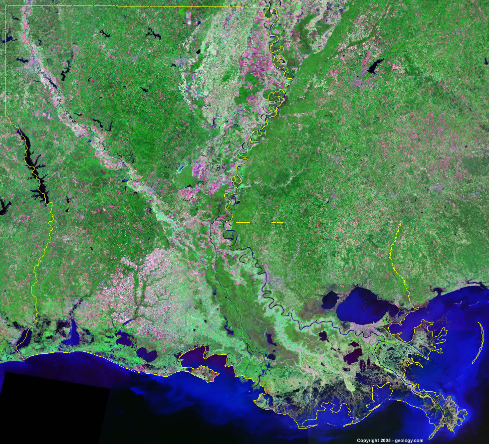
Louisiana Satellite Image - View Cities, Rivers, Lakes & Environment
Satellite Images for Neighboring States:
Arkansas Mississippi TexasThis is a Landsat GeoCover 2000 satellite image map of Louisiana. Cities, rivers, lakes, mountains and other features shown in this image include:
Louisiana Cities:
Alexandria, LA
Baton Rouge, LA
Houma, LA
Lafayette, LA
Lake Charles, LA
Minden, LA
Monroe, LA
Morgan City, LA
Natchitoches, LA
New Iberia, LA
New Orleans, LA
Ruston, LA
Shreveport, LA
Thibodaux, LA
Louisiana Rivers, Lakes, Water Features:
Atchafalaya River
Bayou D'Arbonne Lake
Bayou Nezpique
Bayou Queue de tortue
Black Lake
Caddo Lake
Calcasieu Lake
Catahoula Lake
Cross Lake
Cyprus Bayou Reservoir
Grand Lake
Lac Des Allemands
Lake Claiborne
Lake Bistineau
Lake Maurepas
Lake Pontchartrain
Lake Salvador
Lake Verret
Larto Lake
Mississippi River
Ouachita River
Red River
Sabine Lake
Saline Lake
Toledo Bend Reservoir
Vernon Lake
White Lake
Other Prominent Louisiana Features:
Atchafalaya Basin
Louisiana farm land
ADVERTISEMENT
More Satellite Images
 State Satellite Images: Color Landsat views of all 50 states. Spectacular images.
 Use Google Earth for FREE: Browse seamless worldwide satellite images. Free.
 Earth from Space at Night: Composite images show worldwide patterns of night light and heat.
 Oil & Gas Fields from Space at Night: Drill pad lighting and flaring make them stand out at night.
 Country Satellite Images: Satellite images for over 170 countries from Landsat GeoCover data.
  Satellite Views of US Cities: Images of 120 cities and their surrounding environment.
 Land Below Sea Level: The top ten locations where land is below the level of the ocean.
  Satellite Views of 64 World Cities: Spectacular images showing the city and surrounding environment.
Copyright information: The images on this page were composed by Angela King and are copyright by Geology.com. These images are not available for use beyond our websites. If you would like to share them with others, please link to this page. The satellite image was produced using Landsat data from NASA.