Home » World Maps » Central America
Central America Map and Satellite Image
- Click a Country


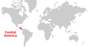
| Central America is an isthmus that connects North and South America, extending from Mexico to Colombia. The Caribbean Sea is on the east coast, and the Pacific Ocean is on the west coast. |
ADVERTISEMENT
Countries in Central America:
Belize, Costa Rica, El Salvador, Guatemala, Honduras, Nicaragua, Panama.Where is Central America?

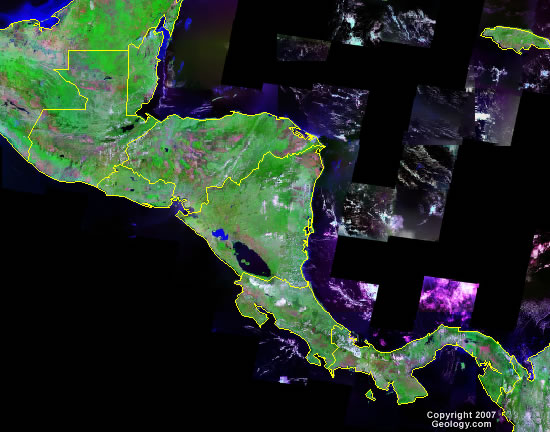
Central America Satellite Image

Central America Cities:
Belmopan, Belize City, Orange Walk, Puerto Barrios, Coban, Quetzaltenango, Guatemala City, Escuintlia, Santa Ana, San Salvador, Santa Rosa de Copan, San Pedro Sula, La Ceiba, Juticalpa, Tegucigalpa, San Miguel, Chinandega, Leon, Managua, Masaya, Puerto Cabezas, Bluefields, Liberia, Puntarenas, San Jose, Puerto Limon, David, Santiago, Chitre, Colon, Panama City, Nargana.Central America Locations:
Bay of Campeche, Caribbean Sea, Gulf of Honduras, Gulf of Panama, Lago de Nicaragua, Pacific Ocean, Panama Canal, San Juan River.Central America Natural Resources:
Central America has large amounts of metal and industrial mineral resources. See individual country reports for more detail.Central America Natural Hazards:
Central America has a wide range of natural hazards. Please consult the individual countries for more detail.Central America Environmental Issues:
Central America has a wide range of environmental issues. Please consult the environmental issues list for specific countries.Central America Bordering Countries:
Mexico, ColombiaADVERTISEMENT

