Home » Satellite Images » US States » Kentucky
Satellite Image of Kentucky
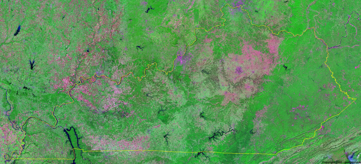
Kentucky Satellite Image - View Cities, Rivers, Lakes & Environment
Satellite Images for Neighboring States:
Illinois Indiana Missouri Ohio Tennessee Virginia West VirginiaThis is a Landsat GeoCover 2000 satellite image map of Kentucky. Cities, rivers, lakes, mountains and other features shown in this image include:
Kentucky Cities:
Alexandria, KY
Ashland, KY
Bowling Green, KY
Frankfort, KY
Hopkinsville, KY
Independence, KY
Jeffersontown, KY
Lexington, KY
Louisville, KY
Murry, KY
Owensboro, KY
Paducah, KY
Somerset, KY
Kentucky Rivers, Lakes, Water Features:
Barren River Lake
Cave Run Lake
Cumberland River
Dale Hollow Lake
Green River Lake
Kentucky Lake
Kentucky River
Lake Barkley
Lake Cumberland
Laural River Lake
Mississippi River
Nolin River Lake
Ohio River
Paintsville Lake
Rough River Lake
Taylorsville Lake
Tennessee River
Wood Creek Lake
Yatesville Lake
Other Prominent Kentucky Features:
Big Stone Ridge
Cumberland Plateau Region
Kentucky farm land
ADVERTISEMENT
More Satellite Images
 State Satellite Images: Color Landsat views of all 50 states. Spectacular images.
 Use Google Earth for FREE: Browse seamless worldwide satellite images. Free.
 Earth from Space at Night: Composite images show worldwide patterns of night light and heat.
 Oil & Gas Fields from Space at Night: Drill pad lighting and flaring make them stand out at night.
 Country Satellite Images: Satellite images for over 170 countries from Landsat GeoCover data.
  Satellite Views of US Cities: Images of 120 cities and their surrounding environment.
 Land Below Sea Level: The top ten locations where land is below the level of the ocean.
  Satellite Views of 64 World Cities: Spectacular images showing the city and surrounding environment.
Copyright information: The images on this page were composed by Angela King and are copyright by Geology.com. These images are not available for use beyond our websites. If you would like to share them with others, please link to this page. The satellite image was produced using Landsat data from NASA.