Home » US Maps » Colorado Maps
Colorado Map Collection

Colorado County Map:
This map shows Colorado's 64 counties. Also available is a detailed Colorado County Map with county seat cities.
ADVERTISEMENT


Map of Colorado Cities:
This map shows many of Colorado's important cities and most important roads. The important north - south route is Interstate 25. Important east - west routes include: Interstate 70 and Interstate 76. We also have a more detailed Map of Colorado Cities.
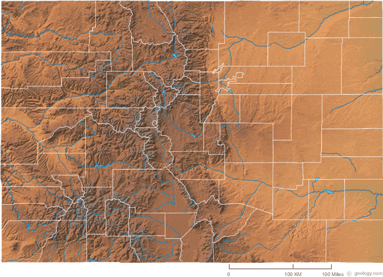
Colorado Physical Map:
This Colorado shaded relief map shows the major physical features of the state. For other nice views of the state, see our Colorado Satellite image or the Colorado map by Google.
ADVERTISEMENT

Colorado Rivers Map:
This map shows the major streams and rivers of Colorado and some of the larger lakes. The Great Continental Divide crosses Colorado. The eastern part of the state is in the Gulf of America Watershed and the western part of the state is in the Pacific Ocean Watershed. Major streams that drain the state include the Arkansas, Platte and Colorado Rivers. Most of these lakes and streams can be clearly seen on the Colorado Satellite Image. We also have a page about Colorado water resources.
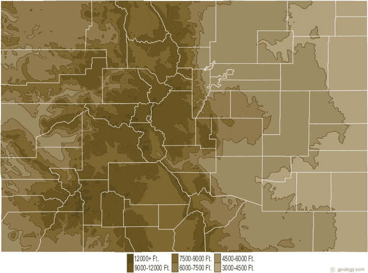
Colorado Elevation Map:
This is a generalized topographic map of Colorado. It shows elevation trends across the state. Detailed topographic maps and aerial photos of Colorado are available in the Geology.com store. See our state high points map to learn about Mt. Elbert at 14,433 feet - the highest point in Colorado. The lowest point is the Arikaree River at 3,315 feet.