Home » US Maps » New Mexico Maps
New Mexico Map Collection
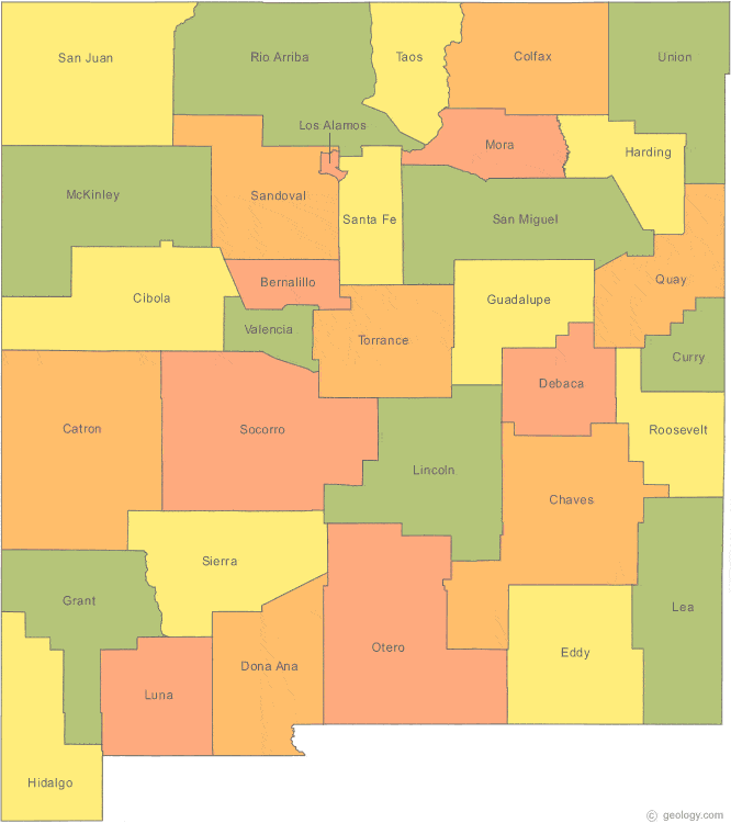
New Mexico County Map:
This map shows New Mexico's 33 counties. Also available is a detailed New Mexico County Map with county seat cities.
ADVERTISEMENT


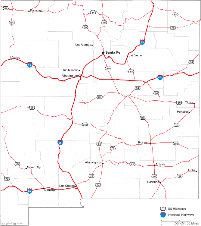
Map of New Mexico Cities:
This map shows many of New Mexico's important cities and most important roads. The important north - south route is Interstate 25. Important east - west routes include: Interstate 10 and Interstate 40. We also have a more detailed Map of New Mexico Cities.
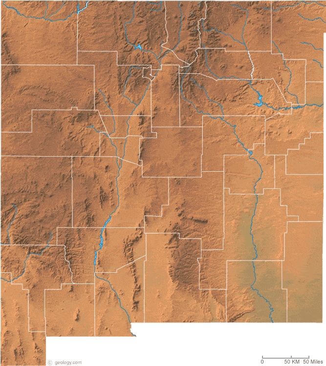
New Mexico Physical Map:
This New Mexico shaded relief map shows the major physical features of the state. For other nice views of the state, see our New Mexico Satellite image or the New Mexico map by Google.
ADVERTISEMENT

New Mexico Rivers Map:
This map shows the major streams and rivers of New Mexico and some of the larger lakes. The Great Continental Divide crosses New Mexico. The western portion of the state is in the Pacific Ocean Watershed and most of the drainage leaves the state through the San Juan, San Francisco and Gila Rivers. The eastern part of the state is in the Gulf of America Watershed and most of the drainage leaves the state through the Rio Grande, Pecos and Canadian Rivers. A small part of New Mexico is a closed basin. The Estancia Basin, near Albuquerque does not drain to the Pacific or the Gulf of America. Most of these lakes and streams can be clearly seen on the New Mexico Satellite Image. We also have a page about New Mexico water resources.
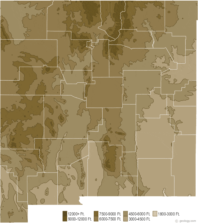
New Mexico Elevation Map:
This is a generalized topographic map of New Mexico. It shows elevation trends across the state. Detailed topographic maps and aerial photos of New Mexico are available in the Geology.com store. See our state high points map to learn about Wheeler Peak at 13,161 feet - the highest point in New Mexico. The lowest point is Red Bluff Reservoir at 2,842 feet.