Oregon Map Collection

Oregon County Map:
This map shows Oregon's 36 counties. Also available is a detailed Oregon County Map with county seat cities.
ADVERTISEMENT


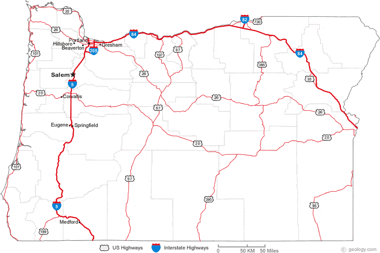
Map of Oregon Cities:
This map shows many of Oregon's important cities and most important roads. The important north - south route is Interstate 5. The important east - west route is Interstate 84. We also have a more detailed Map of Oregon Cities.

Oregon Physical Map:
This Oregon shaded relief map shows the major physical features of the state. For other nice views of the state, see our Oregon Satellite image or the Oregon map by Google.
ADVERTISEMENT

Oregon Rivers Map:
This map shows the major streams and rivers of Oregon and some of the larger lakes. Most of Oregon is in the Pacific Ocean Watershed and much of the drainage in this area is carried to the Pacific through the Columbia River. The westernmost part of the state drains directly into the Pacific through streams such as the Nehalem, Umpqua and Rogue Rivers. Small areas in southeastern Oregon are in the Great Basin, an area of the United States with internal drainage that does not contribute water to an ocean. Most of these lakes and streams can be clearly seen on the Oregon Satellite Image. We also have a page about Oregon water resources.
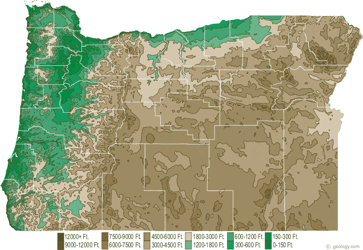
Oregon Elevation Map:
This is a generalized topographic map of Oregon. It shows elevation trends across the state. Detailed topographic maps and aerial photos of Oregon are available in the Geology.com store. See our state high points map to learn about Mt. Hood at 11,239 feet - the highest point in Oregon. The lowest point is the Pacific Ocean at Sea Level.