Home » US Maps » Pennsylvania Maps
Pennsylvania Map Collection
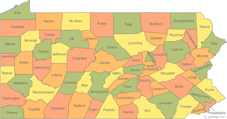
Pennsylvania County Map:
This map shows Pennsylvania's 67 counties. Also available is a detailed Pennsylvania County Map with county seat cities.
ADVERTISEMENT


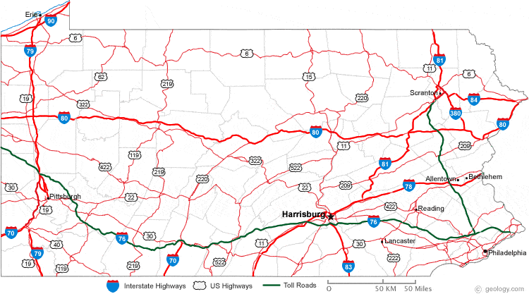
Map of Pennsylvania Cities:
This map shows many of Pennsylvania's important cities and most important roads. Important north - south routes include: Interstate 79, Interstate 81 and Interstate 83. Important east - west routes include: Interstate 70, Interstate 76, Interstate 80, Interstate 84 and Interstate 90. We also have a more detailed Map of Pennsylvania Cities.

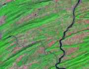
Pennsylvania Physical Map:
This Pennsylvania shaded relief map shows the major physical features of the state. For other nice views of the state, see our Pennsylvania Satellite image or the Pennsylvania map by Google.
ADVERTISEMENT
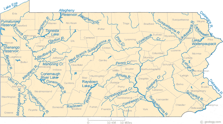
Pennsylvania Rivers Map:
This map shows the major streams and rivers of Pennsylvania and some of the larger lakes. The state's drainage systems are separated by the Eastern Continental Divide and the St. Lawrence Seaway Divide. The eastern and central parts of the state are within the Atlantic Ocean Watershed. Within this watershed the Susquehanna River drains much of Pennsylvania and enters Chesapeake Bay while the Delaware River forms the eastern boundary of Pennsylvania and drains into Delaware Bay. Small portions of Erie and Potter Counties drain into Lake Erie and are in the St. Lawrence Watershed. The remainder of the state is in the Mississippi River Watershed. One of five North American Triple Points is located in Pennsylvania. An unnamed hill in Potter County is the intersection of Eastern Continental Divide and the St. Lawrence Seaway Divide. Most of these lakes and streams can be clearly seen on the Pennsylvania Satellite Image. We also have a page about Pennsylvania water resources.
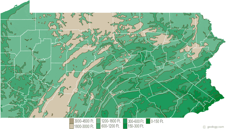
Pennsylvania Elevation Map:
This is a generalized topographic map of Pennsylvania. It shows elevation trends across the state. Detailed topographic maps and aerial photos of Pennsylvania are available in the Geology.com store. See our state high points map to learn about Mt. Davis at 3,213 feet - the highest point in Pennsylvania. The lowest point is the Delaware River at Sea Level.