Home » US Maps » Pennsylvania » Lakes and Rivers
Pennsylvania Lakes, Rivers and Water Resources
ADVERTISEMENT
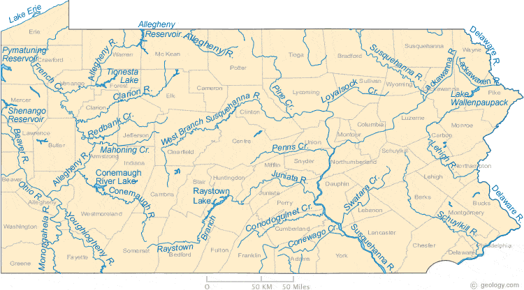
Pennsylvania Rivers Shown on the Map: Allegheny River, Beaver River, Clarion River, Conemaugh River, Conewago Creek, Conodoguinet Creek, Delaware River, French Creek, Juniata River, Lackawanna River, Lackawaxen River, Lehigh River, Loyalsock Creek, Mahoning Creek, Monongahela River, Ohio River, Penns Creek, Pine Creek, Raystown Branch Juniata River, Redbank Creek, Schuylkill River, Susquehanna River, Swatara Creek, West Branch Susquehanna River and Youghiogheny River.
Pennsylvania Lakes Shown on the Map: Allegheny Reservoir, Conemaugh River Lake, Lake Erie, Lake Wallenpaupack, Pymatuning Reservoir, Raystown lake, Shenango Reservoir and Tionesta Lake.
| Pennsylvania Stream and River Levels |
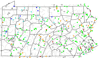 The United States Geological Survey has a number of stream gages located throughout Pennsylvania. These estimate stream levels, discharges and record them over time. This data is published on the web and many stations allow users to plot custom graphs. Get updated Pennsylvania river and stream levels from USGS here.
| Pennsylvania Stream and River Level Alerts |
 The United States Geological Survey has a system that will send you an email message when flood levels are reached on any stream with USGS gaging equipment that you have selected. Sign up here to receive Pennsylvania stream and river level alerts.

| Pennsylvania Drought Map |
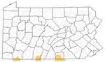 The United States Geological Survey publishes updated drought maps on their website. There you can view a map that shows where below normal 7-day average stream flow conditions were recently recorded. The maps are updated daily. Get a current Pennsylvania drought map here.
| Pennsylvania Water Publications |
 The United States Geological Survey has a number of publications related to water use and water resources in Pennsylvania. Visit the Pennsylvania Water Science Center here.
| Pennsylvania Elevation Map |
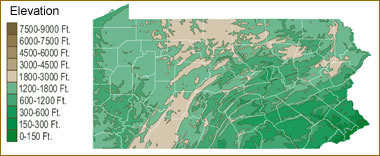 The topography of an area determines the direction of stream flow and often is a primary influence on the geographic distribution of precipitation. View a detailed Pennsylvania elevation map.


Find Other Topics on Geology.com:

|

| ||

|

| ||

|

| ||

|

|