Home » US Maps » South Carolina Maps
South Carolina Map Collection

South Carolina County Map:
This map shows South Carolina's 46 counties. Also available is a detailed South Carolina County Map with county seat cities.
ADVERTISEMENT


Map of South Carolina Cities:
This map shows many of South Carolina's important cities and most important roads. Important north - south routes include: Interstate 77, Interstate 85 and Interstate 95. Important east - west routes include: Interstate 20 and Interstate 26. We also have a more detailed Map of South Carolina Cities.
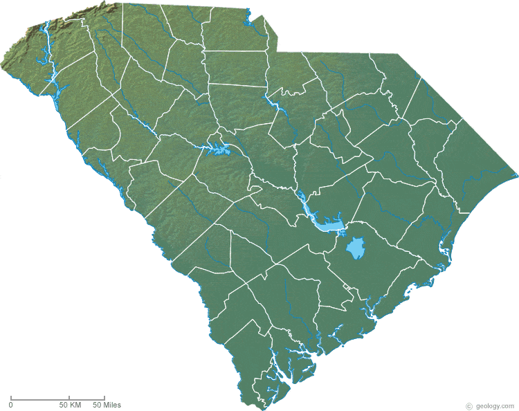
South Carolina Physical Map:
This South Carolina shaded relief map shows the major physical features of the state. For other nice views of the state, see our South Carolina Satellite image or the South Carolina map by Google.
ADVERTISEMENT
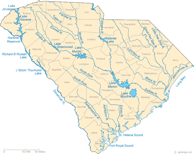
South Carolina Rivers Map:
This map shows the major streams and rivers of South Carolina and some of the larger lakes. South Carolina is in the Atlantic Ocean Watershed and streams flow eastward and drain into the Atlantic Ocean. Most of the state's drainage is carried by the Waccamaw, Black, Santee, Edisto, Salkehatchie and Savannah Rivers. Most of these lakes and streams can be clearly seen on the South Carolina Satellite Image. We also have a page about South Carolina water resources.
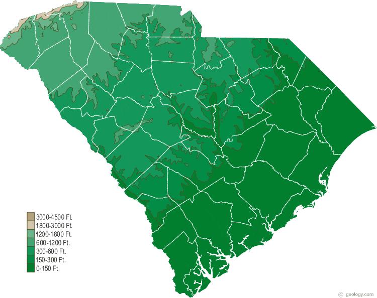
South Carolina Elevation Map:
This is a generalized topographic map of South Carolina. It shows elevation trends across the state. Detailed topographic maps and aerial photos of South Carolina are available in the Geology.com store. See our state high points map to learn about Sassafras Mtn. at 3,560 feet - the highest point in South Carolina. The lowest point is the Atlantic Ocean at Sea Level.