Home » World Maps » North America » Caribbean Islands » Puerto Rico
Puerto Rico Map and Satellite Image
Puerto Rico Map of Cities, Roads, and Rivers

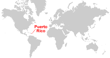
| Puerto Rico is a territory of the United States located between the Caribbean Sea and the Atlantic Ocean, east of the Dominican Republic. Puerto Rico consists of the main island of Puerto Rico along with over 140 smaller islands. |
ADVERTISEMENT
Puerto Rico Bordering Countries:
NoneRegional Maps:
Map of the Caribbean Islands, Map of the United States, Map of North America, World MapPuerto Rico Municipalities Map

Puerto Rico Municipalities | |||
| 1 | Aguadilla | 40 | Las Piedras |
| 2 | Isabela | 41 | Naguabo |
| 3 | Quebradillas | 42 | Ceiba |
| 4 | Camuy | 43 | Anasco |
| 5 | Hatillo | 44 | Mayaguez |
| 6 | Arecibo | 45 | Las Marias |
| 7 | Barceloneta | 46 | Maricao |
| 8 | Florida | 47 | Adjuntas |
| 9 | Manati | 48 | Jayuya |
| 10 | Vega Baja | 49 | Orocovis |
| 11 | Vega Alta | 50 | Barranquitas |
| 12 | Dorado | 51 | Comerio |
| 13 | Toa Baja | 52 | Cidra |
| 14 | Catano | 53 | San Lorenzo |
| 15 | Bayamon | 54 | Humacao |
| 16 | Guaynabo | 55 | Cabo Rojo |
| 17 | San Juan | 56 | Hormigueros |
| 18 | Trujillo Alto | 57 | San German |
| 19 | Carolina | 58 | Sabana Grande |
| 20 | Loiza | 59 | Lajas |
| 21 | Canovanas | 60 | Guanica |
| 22 | Rio Grande | 61 | Yauco |
| 23 | Luquillo | 62 | Guayanilla |
| 24 | Fajardo | 63 | Penuelas |
| 25 | Rincon | 64 | Ponce |
| 26 | Aguada | 65 | Juana Diaz |
| 27 | Moca | 66 | Villalba |
| 28 | San Sebastian | 67 | Coamo |
| 29 | Lares | 68 | Aibonito |
| 30 | Utuado | 69 | Cayey |
| 31 | Ciales | 70 | Santa Isabel |
| 32 | Morovis | 71 | Salinas |
| 33 | Corozal | 72 | Guayama |
| 34 | Toa Alta | 73 | Arroyo |
| 35 | Naranjito | 74 | Patillas |
| 36 | Aguas Buenas | 75 | Maunabo |
| 37 | Caguas | 76 | Yabucoa |
| 38 | Gurabo | 77 | Vieques |
| 39 | Juncos | 78 | Culebra |
Where is Puerto Rico?
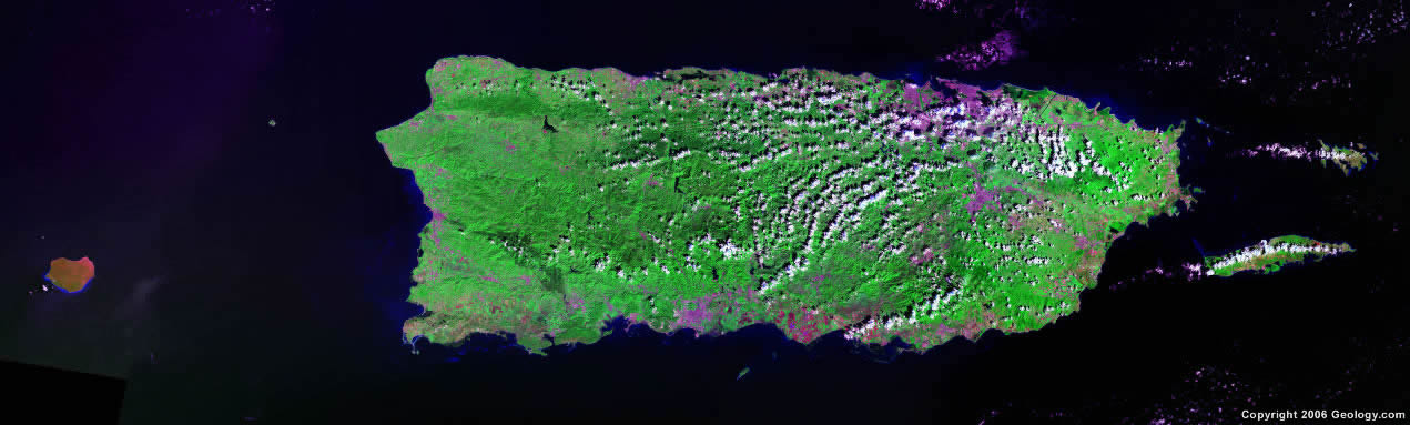
Puerto Rico Satellite Image
ADVERTISEMENT

Explore Puerto Rico Using Google Earth:
Google Earth is a free program from Google that allows you to explore satellite images showing the cities and landscapes of Puerto Rico and all of the Caribbean in fantastic detail. It works on your desktop computer, tablet, or mobile phone. The images in many areas are detailed enough that you can see houses, vehicles and even people on a city street. Google Earth is free and easy-to-use.
Puerto Rico on a World Wall Map:
Puerto Rico and nearly 200 countries are illustrated on our Blue Ocean Laminated Map of the World. This map shows a combination of political and physical features. It includes country boundaries, major cities, major mountains in shaded relief, ocean depth in blue color gradient, along with many other features. This is a great map for students, schools, offices and anywhere that a nice map of the world is needed for education, display or decor.
Puerto Rico On a Large Wall Map of North America:
If you are interested in Puerto Rico and the geography of North America, our large laminated map of North America might be just what you need. It is a large political map of North America that also shows many of the continent's physical features in color or shaded relief. Major lakes, rivers, cities, roads, country boundaries, coastlines and surrounding islands are all shown on the map.Puerto Rico Cities:
Adjuntas, Aguadilla, Arecibo, Bayamon, Cabo Rojo, Caguas, Carolina, Cayey, Centro Puntas, Coamo, Comerio, Corozal, Ensenada, Esperanza, Fajardo, Guayama, Humacao, Isabela, Juncos, Manati, Maunabo, Mayaguez, Naguabo, Orocovis, Ponce, Quebradillas, Rio Grande, San German, San Juan, San Lorenzo, San Sebastian, Santa Isabel, Segunda, Utuado, Vega Baja and Yauco.Puerto Rico Locations:
Atlantic Ocean, Caribbean Sea, Isla Caja de Muertos, Isla de Culebra, Isla Desecheo, Isla Mona, Isla Vieques, Mona Passage and Sonda de Vieques.Puerto Rico Natural Resources:
Metal resources such as copper and nickel. Puerto Rico also has the commercial potential for onshore and offshore oil.Puerto Rico Natural Hazards:
Puerto Rico experiences some natural hazards such as hurricanes and periodic droughts.Puerto Rico Environmental Issues:
An environmental issue for Puerto Rico is erosion. The islands also experience the occasional drought, which can cause water shortages.
ADVERTISEMENT