Home » World Maps » Canada » New Brunswick
New Brunswick Map - New Brunswick Satellite Image

| New Brunswick is located in eastern Canada. New Brunswick is bordered by the Gulf of St. Lawrence, Quebec to the north, the United States to the west, and Nova Scotia to the south. |
ADVERTISEMENT
New Brunswick Bordering Provinces/Territories:
Nova Scotia, QuebecRegional Maps:
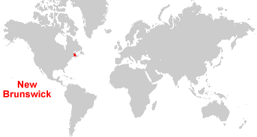
Map of Canada, World MapWhere is New Brunswick?
New Brunswick Satellite Image
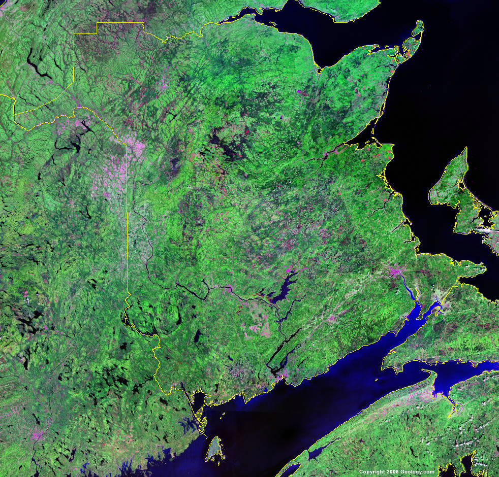
Click for high-resolution image.
ADVERTISEMENT

Explore New Brunswick, Canada Using Google Earth
Google Earth is a free program from Google that allows you to explore satellite images showing the cities and landscapes of New Brunswick and all of North America in fantastic detail. It works on your desktop computer, tablet, or mobile phone. The images in many areas are detailed enough that you can see houses, vehicles and even people on a city street. Google Earth is free and easy-to-use.
Canada Topo Maps
Get a custom printed large-format Canadian Topographic Map on waterproof, laminated or glossy paper. You can center the map anywhere in Canada that you want and adjust the scale with easy-to-use tools on the MyTopo website. They will then print and ship your map rolled in a tube or folded neatly in an envelope - your choice.
New Brunswick, Canada on a World Wall Map
Canada is one of nearly 200 countries illustrated on our Blue Ocean Laminated Map of the World. The Canadian province and territory boundaries are shown on the map along with other political and physical features. It displays symbols for major cities. Major mountains are shown in shaded relief. Ocean depths are indicated with a blue color gradient. This is a great map for students, schools, offices and anywhere that a nice map of the world is needed for education, display or decor.
New Brunswick, Canada On a Large Wall Map of North America
If you are interested in New Brunswick and the geography of Canada, our large laminated map of North America might be just what you need. It is a large political map of North America that also shows many of the continent's physical features in color and shaded relief. Major lakes, rivers, cities, roads, country/province/territory boundaries, coastlines and surrounding islands are all shown on the map.New Brunswick Cities:
Aroostook, Barnaby River, Bath, Bathurst, Bayfield, Benton, Beresford, Berry Mills, Blackville, Boiestown, Bouctouche, Bridge Minto, Bristol, Brockway, Burnsville, Burnt Church, Campbellton, Cape Tormentine, Caraquet, Central Blissville, Chatham, Chipman, Codys, Connors, Cumberland Bay, Debec, Doaktown, Dundas, Durham Bridge, Edmundston, Elgin, Fredericton, Fredericton Junction, Gagetown, Geary, Glassville, Grand Falls, Grand Isle, Hampton, Hartland, Harvey, Heath Steele, Hillsborough, Inkerman, Janeville, Jemseg, Juniper, Kedgwick, Kent Junction, Lac Baker, Lameque, Lawrence Station, Letete, McAdam, Mcgivney, Mcnamee, Meductic, Millerton, Millville, Minto, Miramichi, Miscou Centre, Moncton, Moores Mills, Musquash, Napadogan, Nashwaak, Nauwigewauk, Negauc, Newcastle, Oromocto, Petitcodiac, Plaster Rock, Pointe-Canot, Port Elgin, Prince William, Queenstown, Quispamsis, Red Rapids, Renous, Richibucto Rexton, Ripples, River De Chute, Riverview, Rogersville, Rothesay, Sackville, Saint John, Salisbury, Scoudouc, Shediac, Shippagan, St. Andrews, St. George, St. Leonard, St. Martins, St. Stephen, St.-Isidore, Stanley, Ste. Anne-de-Madawaska, Sussex, Tabusinlac, Tracadie-Sheila, Tracy, Upper Blackville, Upper Kent, Upsalquitch, Waweig, and Woodstock.New Brunswick Lakes, Rivers and Locations:
Bay of Fundy, Cains River, Chaleur Bay, Chignecto Bay, Ciputneticook Lakes, Egmont Bay, Grand Lake, Gulf of St. Lawrence, Long Lake, Miramichi Bay, Saint John River, St. Croix River, St. John River, Tabusintac Bay, and Trousers Lake.