Home » World Maps » Canada » Alberta
Alberta Map - Alberta Satellite Image
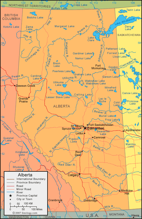
| Alberta is located in western Canada. Alberta is bordered by the United States to the south, British Columbia to the west, Northwest Territories to the north, and Saskatchewan to the east. |
ADVERTISEMENT
Alberta Bordering Provinces/Territories:
British Columbia, Northwest Territories, SaskatchewanRegional Maps:
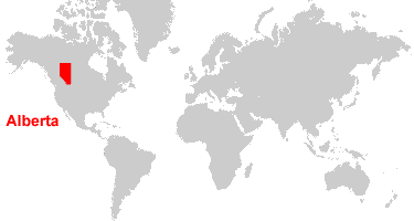
Map of Canada, World MapWhere is Alberta?
Alberta Satellite Image
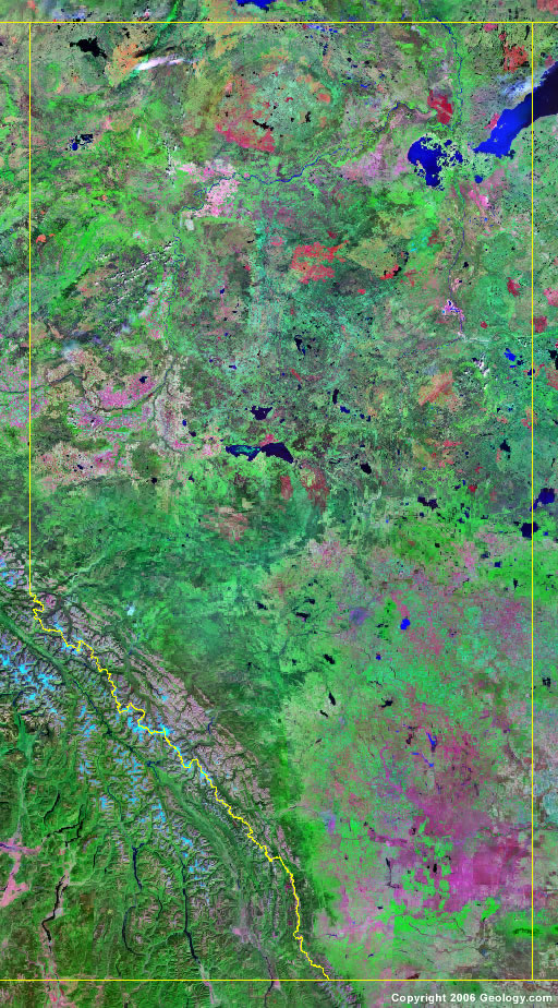
Click for high-resolution image.
ADVERTISEMENT

Explore Alberta, Canada Using Google Earth
Google Earth is a free program from Google that allows you to explore satellite images showing the cities and landscapes of Alberta and all of North America in fantastic detail. It works on your desktop computer, tablet, or mobile phone. The images in many areas are detailed enough that you can see houses, vehicles and even people on a city street. Google Earth is free and easy-to-use.
Canada Topo Maps
Get a custom printed large-format Canadian Topographic Map on waterproof, laminated or glossy paper. You can center the map anywhere in Canada that you want and adjust the scale with easy-to-use tools on the MyTopo website. They will then print and ship your map rolled in a tube or folded neatly in an envelope - your choice.
Alberta, Canada on a World Wall Map
Canada is one of nearly 200 countries illustrated on our Blue Ocean Laminated Map of the World. The Canadian province and territory boundaries are shown on the map along with other political and physical features. It displays symbols for major cities. Major mountains are shown in shaded relief. Ocean depths are indicated with a blue color gradient. This is a great map for students, schools, offices and anywhere that a nice map of the world is needed for education, display or decor.
Alberta, Canada On a Large Wall Map of North America
If you are interested in Alberta and the geography of Canada, our large laminated map of North America might be just what you need. It is a large political map of North America that also shows many of the continent's physical features in color and shaded relief. Major lakes, rivers, cities, roads, country/province/territory boundaries, coastlines and surrounding islands are all shown on the map.Alberta Cities:
Airdrie, Bawlf, Brooks, Calgary, Camrose, Cochrane, Edmonton, Fort Mcmurray, Fort Saskatchewan, Grande Prairie, Hanna, Leduc, Lethbridge, Lloydminster, Medicine Hat, Mirror, Morrin, Okotoks, Red Deer, St. Albert, Spruce Grove, and Wetaskiwin.Alberta Lakes, Rivers and Locations:
Beaverhill Lake, Birch Mountains, Bison Lake, Bistcho Lake, Buffalo Head Hills, Buffalo Lake, Calling Lake, Cardinal Lake, Cold Lake, Frog Lake, Gardiner Lakes, Graham Lake, Lac la Biche, Lake Athabasca, Lake Clare, Lesser Slave Lake, Mamawi Lake, Margaret Lake, McGregor Lake, Muriel Lake, Namur Lake, Peace River, Peerless Lake, Pigeon Lake, Richardson Lake, Rocky Mountains, Sounding Lake, Sullivan Lake, Thickwood Hills, and Wabiskaw Lake.