Home » World Maps » Canada » Saskatchewan
Saskatchewan Map - Saskatchewan Satellite Image
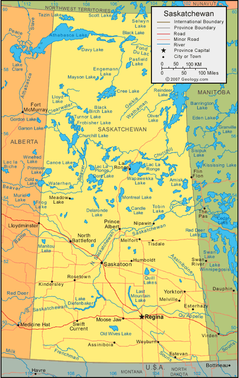
| Saskatchewan is located in central Canada. Saskatchewan is bordered by Alberta to the west, Northwest Territories to the north, Manitoba to the east, and the United States to the south. |
ADVERTISEMENT
Saskatchewan Bordering Provinces/Territories:
Alberta, Manitoba, Northwest Territories, NunavutRegional Maps:
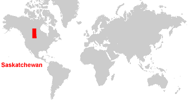
Map of Canada, World MapWhere is Saskatchewan?
Saskatchewan Satellite Image
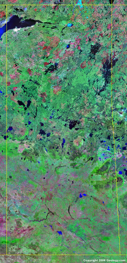
Click for high-resolution image.
ADVERTISEMENT

Explore Saskatchewan, Canada Using Google Earth
Google Earth is a free program from Google that allows you to explore satellite images showing the cities and landscapes of Saskatchewan and all of North America in fantastic detail. It works on your desktop computer, tablet, or mobile phone. The images in many areas are detailed enough that you can see houses, vehicles and even people on a city street. Google Earth is free and easy-to-use.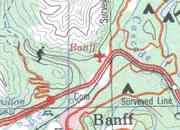
Canada Topo Maps
Get a custom printed large-format Canadian Topographic Map on waterproof, laminated or glossy paper. You can center the map anywhere in Canada that you want and adjust the scale with easy-to-use tools on the MyTopo website. They will then print and ship your map rolled in a tube or folded neatly in an envelope - your choice.
Saskatchewan, Canada on a World Wall Map
Canada is one of nearly 200 countries illustrated on our Blue Ocean Laminated Map of the World. The Canadian province and territory boundaries are shown on the map along with other political and physical features. It displays symbols for major cities. Major mountains are shown in shaded relief. Ocean depths are indicated with a blue color gradient. This is a great map for students, schools, offices and anywhere that a nice map of the world is needed for education, display or decor.
Saskatchewan, Canada On a Large Wall Map of North America
If you are interested in Saskatchewan and the geography of Canada, our large laminated map of North America might be just what you need. It is a large political map of North America that also shows many of the continent's physical features in color and shaded relief. Major lakes, rivers, cities, roads, country/province/territory boundaries, coastlines and surrounding islands are all shown on the map.Saskatchewan Cities:
Assiniboia, Bertwell, Claydon, Climax, Dafoe, Esterhazy, Estevan, Humboldt, Kindersley, La Ronge, Langham, Leader, Meadow Lake, Melfort, Melville, Moose Jaw, Nipawin, North Battleford, Prelate, Prince Albert, Raymore, Regina, Robsart, Rosetown, Saskatoon, Semans, Swift Current, Tisdale, Vidora, Weekes, Weyburn, and Yorkton.Saskatchewan Lakes, Rivers and Locations:
Amisk Lake, Black Birch Lake, Black Lake, Burnett Lake, Candle Lake, Canoe Lake, Clearwater River, Cree Lake, Delaronde Lake, Dore Lake, Engemann Lake, Fond Du Lac, Franklin Lake, Frenchman River, Geikie River, Keeley Lake, Lac La Plonge, Lake Athabasca, Lake Diefenbaker, Last Mountain Lake, Lloyd Lake, Manitou Lake, Mayson Lake, Montreal Lake, Old Wives Lake, Oliver Lake, Oman Lake, Pasfield Lake, Peter Pond Lake, Qu 'Appelle River, Quill Lakes, Reindeer Lake, Riou Lake, Saskatchewan River, Selwyn Lake, Sisipuk Lake, Sled Lake, Tazin Lake, Tobin Lake, Turnor Lake, Waterhen River, and Wathaman River.