Home » World Maps » Canada » Manitoba
Manitoba Map - Manitoba Satellite Image

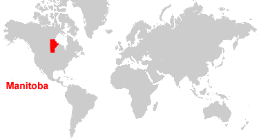
| Manitoba is located in western Canada. Manitoba is bordered the Hudson Bay, Nunavut to the north, Saskatchewan to the west, the United States to the south, and Ontario to the east. |
ADVERTISEMENT
Manitoba Bordering Provinces/Territories:
Northwest Territories, Nunavut, Ontario, SaskatchewanRegional Maps:
Map of Canada, World MapWhere is Manitoba?
Manitoba Satellite Image
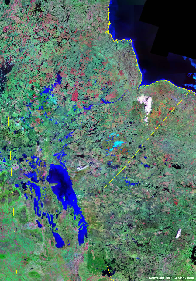
Click for high-resolution image.
ADVERTISEMENT

Explore Manitoba, Canada Using Google Earth
Google Earth is a free program from Google that allows you to explore satellite images showing the cities and landscapes of Manitoba and all of North America in fantastic detail. It works on your desktop computer, tablet, or mobile phone. The images in many areas are detailed enough that you can see houses, vehicles and even people on a city street. Google Earth is free and easy-to-use.
Canada Topo Maps
Get a custom printed large-format Canadian Topographic Map on waterproof, laminated or glossy paper. You can center the map anywhere in Canada that you want and adjust the scale with easy-to-use tools on the MyTopo website. They will then print and ship your map rolled in a tube or folded neatly in an envelope - your choice.
Manitoba, Canada on a World Wall Map
Canada is one of nearly 200 countries illustrated on our Blue Ocean Laminated Map of the World. The Canadian province and territory boundaries are shown on the map along with other political and physical features. It displays symbols for major cities. Major mountains are shown in shaded relief. Ocean depths are indicated with a blue color gradient. This is a great map for students, schools, offices and anywhere that a nice map of the world is needed for education, display or decor.
Manitoba, Canada On a Large Wall Map of North America
If you are interested in Manitoba and the geography of Canada, our large laminated map of North America might be just what you need. It is a large political map of North America that also shows many of the continent's physical features in color and shaded relief. Major lakes, rivers, cities, roads, country/province/territory boundaries, coastlines and surrounding islands are all shown on the map.Manitoba Cities:
Arborg, Barrows, Bowsman, Brandon, Carberry, Carman, Dauphin, Easterville, Flin Flon, Glenboro, Grandview, Gypsumville, Hartney, Minitonas, Minnedosa, Moosehorn, Morden, Neepawa, Pilot Mound, Portage la Prairie, Rapid City, Selkirk, Sifton, Steep Rock, Steinbach, Stonewall, Swan River, The Pas, Thompson, Virden, Winkler, Winnipeg, and Wivenhoe.Manitoba Lakes, Rivers and Locations:
Baldock Lake, Barrington Lake, Big Sand Lake, Cedar Lake, Cross Lake, Dauphin Lake, Family Lake, Fishing Lake, Gauer Lake, Gods Lake, Goldsand Lake, Heindeer Lake, Hudson Bay, Island Lake, Lac Brochet, Lake Manitoba, Lake Winnipeg, Lake Winnipegosis, Misty Lake, Molson Lake, Nelson River, North Knife Lake, North Moose Lake, Nueltin Lake, Oxford Lake, Red Deer Lake, Reindeer Lake, Silsby Lake, South Moose Lake, Southern Indian Lake, Swan Lake, Tadoule Lake, Waskalowaka Lake, Whitemouth Lake, and Wintering Lake.