Home » World Maps » Canada » British Columbia
British Columbia Map - British Columbia Satellite Image

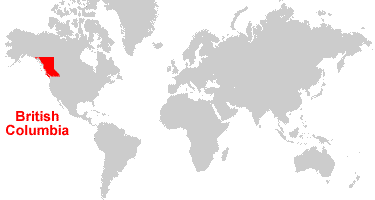
| British Columbia is located in western Canada. British Columbia is bordered by the Pacific Ocean, the United States to the south and west, Yukon Territory and Northwest Territory to the north, and Alberta to the east. |
ADVERTISEMENT
British Columbia Bordering Provinces/Territories:
Alberta, Northwest Territories, Yukon TerritoryRegional Maps:
Map of Canada, World MapWhere is British Columbia?
British Columbia Satellite Image
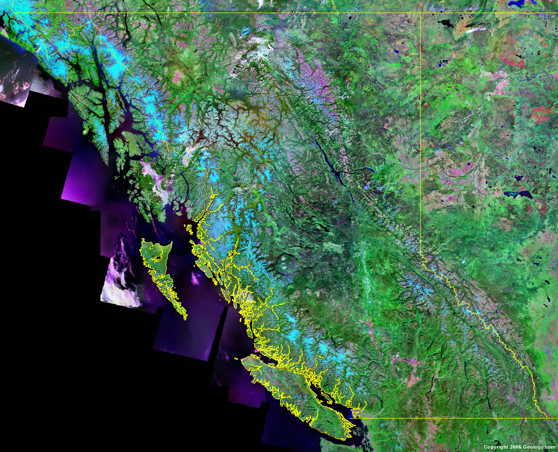
Click for high-resolution image.
ADVERTISEMENT

Explore British Columbia, Canada Using Google Earth
Google Earth is a free program from Google that allows you to explore satellite images showing the cities and landscapes of British Columbia and all of North America in fantastic detail. It works on your desktop computer, tablet, or mobile phone. The images in many areas are detailed enough that you can see houses, vehicles and even people on a city street. Google Earth is free and easy-to-use.
Canada Topo Maps
Get a custom printed large-format Canadian Topographic Map on waterproof, laminated or glossy paper. You can center the map anywhere in Canada that you want and adjust the scale with easy-to-use tools on the MyTopo website. They will then print and ship your map rolled in a tube or folded neatly in an envelope - your choice.
British Columbia, Canada on a World Wall Map
Canada is one of nearly 200 countries illustrated on our Blue Ocean Laminated Map of the World. The Canadian province and territory boundaries are shown on the map along with other political and physical features. It displays symbols for major cities. Major mountains are shown in shaded relief. Ocean depths are indicated with a blue color gradient. This is a great map for students, schools, offices and anywhere that a nice map of the world is needed for education, display or decor.
British Columbia, Canada On a Large Wall Map of North America
If you are interested in British Columbia and the geography of Canada, our large laminated map of North America might be just what you need. It is a large political map of North America that also shows many of the continent's physical features in color and shaded relief. Major lakes, rivers, cities, roads, country/province/territory boundaries, coastlines and surrounding islands are all shown on the map.British Columbia Cities:
Campbell River, Chilliwack, Cranbrook, Dawson Creek, Duncan, Kamloops, Kelowna, Kitimat, Maple Ridge, Mission, Nanaimo, New Westminster, Parksville, Penticton, Powell River, Prince George, Prince Rupert, Salmon Arm, Sidney, Squamish, Surrey, Terrace, Vancouver, Vernon, Victoria, and Williams Lake.British Columbia Lakes, Rivers and Locations:
Atlin Lake, Babine Lake, Cariboo Mountains, Cassiar Mountains, Charlotte Lake, Chilko Lake, Coast Mountains, Columbia Mountains, Eutsuk Lake, Francois Lake, Hecate Strait, Kinbasket Lake, Kooteney Lake, Kotcho Lake, Lower Arrow Lake, Maxhamish Lake, Morice Lake, Okanagan Lake, Ootsa Lake, Pacific Ocean, Queens Sound, Quesnel Lake, Rocky Mountains, Shuswao Lake, Skeena Mountains, Smith Sound, Stikine Ranges, Strait of Georgia, Strait of Juan de Fuca, Stuart Lake, Tahtsa Lake, Takla Lake, Teslin Lake, Tetachuck Lake, Upper Arrow Lake, and Williston Lake.