Home » US Maps » Delaware » Roads and Cities
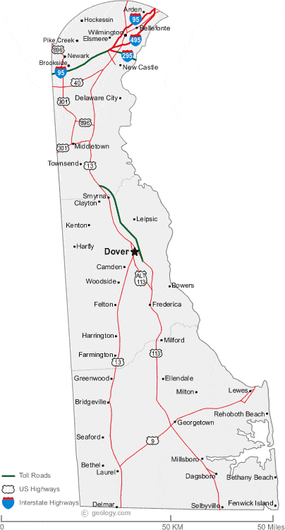
Map of Delaware Cities and Roads
ADVERTISEMENT
City Maps for Neighboring States:
Maryland New Jersey Pennsylvania


Delaware Cities:
Cities with populations over 10,000 include: Brookside, Dover, Hockessin, Newark, Pike Creek and Wilmington.
Delaware Interstates:
North-South interstates include: Interstate 95, Interstate 295 and Interstate 495.
Delaware Routes:
US Highways and State Routes include: Route 9, Route 13, Route 40, Route 113, Route 301 and Route 896.
ADVERTISEMENT

