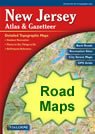
Home » US Maps » New Jersey » Roads and Cities
Map of New Jersey Cities and Roads

ADVERTISEMENT
City Maps for Neighboring States:
Delaware New York Pennsylvania


New Jersey Cities:
Cities with populations over 10,000 include: Asbury Park, Atlantic City, Bayonne, Beachwood, Bellmawr, Bridgeton, Brigantine, Camden, Carteret, Clifton, Collingswood, Dover, East Orange, Eatontown, Elizabeth, Freehold, Glassboro, Gloucester City, Haddonfield, Hammonton, Highland Park, Hillsdale, Hopatcong, Jersey City, Keansburg, Lincoln Park, Linden, Lindenwold, Long Branch, Manville, Marlton, Metuchen, Middlesex, Millville, Moorestown, Morristown, New Brunswick, New Providence, Newark, North Bergen, Oakland, Ocean City, Passaic, Paterson, Pennsville, Perth Amboy, Phillipsburg, Pine Hill, Pleasantville, Point Pleasant, Pompton Lakes, Princeton, Rahway, Ramsey, Red Bank, Ringwood, Sayreville, Somers Point, Somerville, South River, Summit, Tinton Falls, Trenton, Union City, Ventnor City, Vineland, Waldwick, Wanaque, Williamstown and Woodbury.
New Jersey Interstates:
North-South interstates include: Interstate 95, Interstate 287 and Interstate 295. East-West interstates include: Interstate 78 and Interstate 80.
New Jersey Routes:
US Highways and State Routes include: Route 1, Route 9, Route 22, Route 30, Route 40, Route 46, Route 130, Route 202, Route 206 and Route 322.
ADVERTISEMENT

