Home » US Maps » Georgia » Roads and Cities
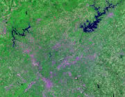
Map of Georgia Cities and Roads

ADVERTISEMENT
City Maps for Neighboring States:
Alabama Florida North Carolina South Carolina Tennessee


Georgia Cities:
Cities with populations over 10,000 include: Albany, Alpharetta, Americus, Athens, Atlanta, Augusta, Bainbridge, Brunswick, Buford, Carrollton, Cartersville, College Park, Columbus, Cordele, Covington, Dalton, Decatur, Douglas , Douglasville, Dublin, Duluth, East Point, Forest Park, Gainesville, Griffin, Hinesville, Kennesaw, Kingsland, La Grange, Lawrenceville, Lilburn, Macon, Marietta, Milledgeville, Monroe, Moultrie, Newnan, Peachtree City, Powder Springs, Rome, Roswell, Saint Marys, Savannah, Smyrna, Snellville, Statesboro, Thomasville, Tifton, Union City, Valdosta, Vidalia, Warner Robins and Waycross.
Georgia Interstates:
North-South interstates include: Interstate 59, Interstate 75, Interstate 85, Interstate 95 and Interstate 185. East-West interstates include: Interstate 16 and Interstate 20.
Georgia Routes:
US Highways and State Routes include: Route 1, Route 17, Route 19, Route 23, Route 25, Route 27, Route 27A, Route 29, Route 41, Route 76, Route 78, Route 80, Route 82, Route 84, Route 129, Route 221, Route 278, route 280, Route 301, Route 319, Route 341, Route 378 and Route 441.
ADVERTISEMENT

