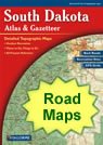
geology

Map of South Dakota Cities - South Dakota Road Map


map of South Dakota cities
Free Download - High Resolution City Satellite Images

South Dakota Cities

:
Cities with populations over 10,000 include: Aberdeen, Brookings, Huron, Mitchell, Rapid City, Sioux Falls, Vermillion, Watertown and Yankton.

South Dakota Interstates

:
North-South interstates include: Interstate 29. East-West interstates include: Interstate 90.

South Dakota Routes

:
US Highways and State Routes include: Route 12, Route 14, Route 16, Route 18, Route 81, Route 83, Route 85, Route 183, Route 212, Route 281 and Route 385.

Nearby States

:
Iowa   Minnesota   Montana   Nebraska   North Dakota   Wyoming

Click a State for More Maps


clickable USA map
 

More South Dakota From Geology.com

South Dakota Physical Map South Dakota Physical Map
South Dakota Waterfalls Map South Dakota Waterfalls Map
South Dakota County Map South Dakota County Map
South Dakota Roads and Cities Map South Dakota Cities and Roads Map
South Dakota Rivers and lakes map South Dakota Rivers and Lakes Map
South Dakota Elevations Map South Dakota Elevation Map
Highest point in South Dakota Map Highest Point in South Dakota Map
South Dakota Geology in the News South Dakota Geology News
South Dakota Satellite Image South Dakota Satellite Image
Roadside Geology of South Dakota Roadside Geology of South Dakota

Copyright information: The maps on this page were composed by Brad Cole of Geology.com. If you want to share these maps with others please link to this page. These maps are property of Geology.com © 2006 and may not be used beyond our websites. They were created using data licensed from and copyright by Map Resources © 2006.
© 2005-2008 Geology.com. All Rights Reserved.
Images, code and content of this website are property of Geology.com. Use without permission is prohibited. Pages on this site are protected by Copyscape.