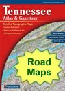
geology
World country maps

Map of Tennessee Cities - Tennessee Road Map


map of Tennessee cities

Road Maps of Nearby States

: Alabama   Arkansas   Georgia   Kentucky   Mississippi   Missouri   North Carolina   Virginia  

Tennessee DeLorme Atlas Tennessee
Road Atlas
Detailed road maps, including back roads, for an entire state in a single convenient book. Get one for your next trip!
  USA wall map
Tennessee
Wall Map
 
Terrain Navigator mapping software Tennessee
Mapping Software
View, annotate and print detailed topographic maps for the entire state of Tennessee. Terrain Navigator is the perfect tool for hikers, hunters and those who work in the field.
City Satellite Images
City satellite images

Tennessee Cities

:
Cities with populations over 10,000 include: Athens, Bartlett, Brentwood, Bristol, Brownsville, Chattanooga, Clarksville, Cleveland, Collierville, Columbia, Cookeville, Dickson, Dyersburg, East Ridge, Elizabethton, Farragut, Franklin, Gallatin, Goodlettsville, Greeneville, Hendersonville, Jackson, Johnson City, Kingsport, Knoxville, La Vergne, Lawrenceburg, Lebanon, Lewisburg, Maryville, McMinnville, Millington, Morristown, Murfreesboro, Red Bank, Sevierville, Shelbyville, Smyrna, Springfield, Tullahoma and Union City.

Tennessee Interstates

:
North-South interstates include: Interstate 65, Interstate 75 and Interstate 81. East-West interstates include: Interstate 24 and Interstate 40.

Tennessee Routes

:
US Highways and State Routes include: Route 11, Route 11E, Route 11W, Route 19E, Route 23, Route 25E, Route 27, Route 31, Route 31E, Route 41, Route 41A, Route 45, Route 45E, Route 45W, Route 51, Route 64, Route 70, Route 70N, Route 70S, Route 79, Route 127, Route 129, Route 176, Route 231, Route 321, Route 411, Route 412, Route 421, Route 431 and Route 641.

Click a State for More Maps


clickable USA map
Tennessee Physical Map TN Physical Map
Tennessee Waterfalls Map TN Waterfalls Map
Tennessee County Map TN County Map
Tennessee Roads and Cities Map TN Cities and Roads Map
Nashville Satellite Image TN City Satellite Images
Tennessee Rivers and lakes map TN Rivers and Lakes Map
Tennessee Elevations Map TN Elevation Map
Highest point in Tennessee Map Highest Point in TN Map
Tennessee Geology in the News TN Geology News
Tennessee Satellite Image TN Satellite Image

Copyright information: The maps on this page were composed by Brad Cole of Geology.com. If you want to share these maps with others please link to this page. These maps are property of Geology.com © 2006 and may not be used beyond our websites. They were created using data licensed from and copyright by Map Resources © 2006.
© 2005-2010 Geology.com. All Rights Reserved.
Images, code and content of this website are property of Geology.com. Use without permission is prohibited. Pages on this site are protected by Copyscape.