Home » US Maps » Florida » County Map
Florida County Map with County Seat Cities

ADVERTISEMENT
County Maps for Neighboring States:
Alabama Georgia
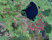


The map above is a Landsat satellite image of Florida with County boundaries superimposed. We have a more detailed satellite image of Florida without County boundaries.


ADVERTISEMENT
Florida Counties and County Seats |
|
|
Alachua County - Gainesville Baker County - Macclenny Bay County - Panama City Bradford County - Starke Brevard County - Titusville Broward County - Fort Lauderdale Calhoun County - Blountstown Charlotte County - Punta Gorda Citrus County - Inverness Clay County - Green Cove Springs Collier County - Naples Columbia County - Lake City De Soto County - Arcadia Dixie County - Cross City Duval County - Jacksonville Escambia County - Pensacola Flagler County - Bunnell Franklin County - Apalachicola Gadsden County - Quincy Gilchrist County - Trenton Glades County - Moore Haven Gulf County - Port St. Joe Hamilton County - Jasper Hardee County - Wauchula Hendry County - LaBelle Hernando County - Brooksville Highlands County - Sebring Hillsborough County - Tampa Holmes County - Bonifay Indian River County - Vero Beach Jackson County - Marianna Jefferson County - Monticello Lafayette County - Mayo Lake County - Tavares |
Lee County - Fort Myers Leon County - Tallahassee Levy County - Bronson Liberty County - Bristol Madison County - Madison Manatee County - Bradenton Marion County - Ocala Martin County - Stuart Miami-Dade County - Miami Monroe County - Key West Nassau County - Fernandina Beach Okaloosa County - Crestview Okeechobee County - Okeechobee Orange County - Orlando Osceola County - Kissimmee Palm Beach County - West Palm Beach Pasco County - Dade City Pinellas County - Clearwater Polk County - Bartow Putnam County - Palatka Santa Rosa County - Milton Sarasota County - Sarasota Seminole County - Sanford St. Johns County - St. Augustine St. Lucie County - Fort Pierce Sumter County - Bushnell Suwannee County - Live Oak Taylor County - Perry Union County - Lake Butler Volusia County - DeLand Wakulla County - Crawfordville Walton County - De Funiak Springs Washington County - Chipley |
