geology
World country maps

Maryland County Map with Administrative Cities


Map of Maryland Counties

Maps for Neighboring States

: Delaware   Pennsylvania   Virginia   West Virginia

Maryland DeLorme Atlas Maryland
Road Atlas
Detailed road maps, including back roads, for an entire state in a single convenient book. Get one for your next trip!
  USA wall map
Maryland
Wall Map
 
Terrain Navigator mapping software Maryland
Mapping Software
View, annotate and print detailed topographic maps for the entire state of Maryland. Terrain Navigator is the perfect tool for hikers, hunters and those who work in the field.

Maryland County Map
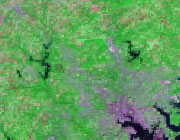
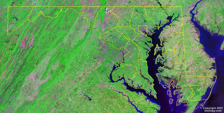
The map above is a Landsat satellite image of Maryland with County boundaries superimposed. We have another satellite image of Maryland without County boundaries and a Landsat tutorial that can help you learn how to read these images.

City Satellite Images
City satellite images


Maryland Counties and County Seats

Allegany County - Cumberland
Anne Arundel County - Annapolis
Baltimore County - Towson
Calvert County - Prince Frederick
Caroline County - Denton
Carroll County - Westminster
Cecil County - Elkton
Charles County - La Plata
Dorchester County - Cambridge
Frederick County - Frederick
Garrett County - Oakland
Harford County - Bel Air
Howard County - Ellicott City
Kent County - Chestertown
Montgomery County - Rockville
Prince George's County - Upper Marlboro
Queen Anne's County - Centreville
Somerset County - Princess Anne
St. Mary's County - Leonardtown
Talbot County - Easton
Washington County - Hagerstown
Wicomico County - Salisbury
Worcester County - Snow Hill

Click a State for More Maps


clickable USA map
Maryland Physical Map MD Physical Map
Maryland Waterfalls Map MD Waterfalls Map
Maryland County Map MD County Map
Maryland Roads and Cities Map MD Cities and Roads Map
Maryland rivers and lakes map MD Rivers and Lakes Map
Maryland Elevations Map MD Elevation Map
Highest point in Maryland Map Highest Point in MD Map
Maryland Geology in the News MD Geology News
Maryland Satellite Image MD Satellite Image
Marcellus Shale in Maryland Marcellus Shale in MD

Copyright information: The maps on this page were composed by Brad Cole of Geology.com. If you want to share these maps with others please link to this page. These maps are property of Geology.com © 2006 and may not be used beyond our websites. They were created using data licensed from and copyright by Map Resources © 2006.
© 2005-2010 Geology.com. All Rights Reserved.
Images, code and content of this website are property of Geology.com. Use without permission is prohibited. Pages on this site are protected by Copyscape.