Home » US Maps » Virginia » County Map
Virginia County Map with County Seat Cities

ADVERTISEMENT
County Maps for Neighboring States:
Kentucky Maryland North Carolina Tennessee West Virginia
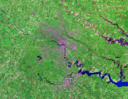


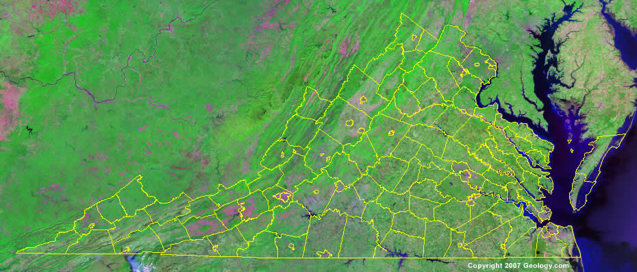
The map above is a Landsat satellite image of Virginia with County boundaries superimposed. We have a more detailed satellite image of Virginia without County boundaries.


ADVERTISEMENT
Virginia Counties and County Seats |
|
|
Accomack County - Accomac Albemarle County - Charlottesville Alleghany County - Covington Amelia County - Amelia Court House Amherst County - Amherst Appomattox County - Appomattox Arlington County - Arlington Augusta County - Staunton Bath County - Warm Springs Bedford County - Bedford Bland County - Bland Botetourt County - Fincastle Brunswick County - Lawrenceville Buchanan County - Grundy Buckingham County - Buckingham Campbell County - Rustburg Caroline County - Bowling Green Carroll County - Hillsville Charles City County - Charles City Charlotte County - Charlotte Courthouse Chesterfield County - Chesterfield Clarke County - Berryville Craig County - New Castle Culpeper County - Culpeper Cumberland County - Cumberland Dickenson County - Clintwood Dinwiddie County - Dinwiddie Essex County - Tappahannock Fairfax County - Fairfax Fauquier County - Warrenton Floyd County - Floyd Fluvanna County - Palmyra Franklin County - Rocky Mount Frederick County - Winchester Giles County - Pearisburg Gloucester County - Gloucester Goochland County - Goochland Grayson County - Independence Greene County - Stanardsville Greensville County - Emporia Halifax County - Halifax Hanover County - Hanover Courthouse Henrico County - Richmond Henry County - Martinsville Highland County - Monterey Isle of Wight County - Isle of Wight James City County - Williamsburg King & Queen County - King and Queen Court House |
King George County - King George King William County - King William Lancaster County - Lancaster Lee County - Jonesville Loudoun County - Leesburg Louisa County - Louisa Lunenburg County - Lunenburg Madison County - Madison Mathews County - Mathews Mecklenburg County - Boydton Middlesex County - Saluda Montgomery County - Christiansburg Nelson County - Lovingston New Kent County - New Kent Northampton County - Eastville Northumberland County - Heathsville Nottoway County - Nottoway Orange County - Orange Page County - Luray Patrick County - Stuart Pittsylvania County - Chatham Powhatan County - Powhatan Prince Edward County - Farmville Prince George County - Prince George Prince William County - Manassas Pulaski County - Pulaski Rappahannock County - Washington Richmond County - Warsaw Roanoke County - Salem Rockbridge County - Lexington Rockingham County - Harrisonburg Russell County - Lebanon Scott County - Gate City Shenandoah County - Woodstock Smyth County - Marion Southampton County - Courtland Spotsylvania County - Spotsylvania Courthouse Stafford County - Stafford Surry County - Surry Sussex County - Sussex Tazewell County - Tazewell Warren County - Front Royal Washington County - Abingdon Westmoreland County - Montross Wise County - Wise Wythe County - Wytheville York County - Yorktown |
