Home » US Maps » Kentucky » County Map
Kentucky County Map with County Seat Cities

ADVERTISEMENT
County Maps for Neighboring States:
Illinois Indiana Missouri Ohio Tennessee Virginia West Virginia
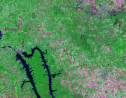


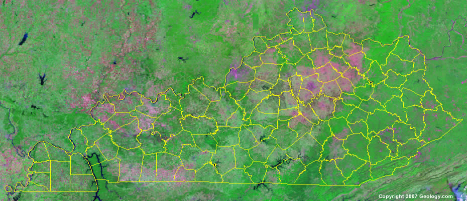
The map above is a Landsat satellite image of Kentucky with County boundaries superimposed. We have a more detailed satellite image of Kentucky without County boundaries.


ADVERTISEMENT
Kentucky Counties and County Seats |
|
|
Adair County - Columbia Allen County - Scottsville Anderson County - Lawrenceburg Ballard County - Wickliffe Barren County - Glasgow Bath County - Owingsville Bell County - Pineville Boone County - Burlington Bourbon County - Paris Boyd County - Catlettsburg Boyle County - Danville Bracken County - Brooksville Breathitt County - Jackson Breckinridge County - Hardinsburg Bullitt County - Shepherdsville Butler County - Morgantown Caldwell County - Princeton Calloway County - Murray Campbell County - Alexandria Carlisle County - Bardwell Carroll County - Carrollton Carter County - Grayson Casey County - Liberty Christian County - Hopkinsville Clark County - Winchester Clay County - Manchester Clinton County - Albany Crittenden County - Marion Cumberland County - Burkesville Daviess County - Owensboro Edmonson County - Brownsville Elliott County - Sandy Hook Estill County - Irvine Fayette County - Lexington Fleming County - Flemingsburg Floyd County - Prestonsburg Franklin County - Frankfort Fulton County - Hickman Gallatin County - Warsaw Garrard County - Lancaster Grant County - Williamstown Graves County - Mayfield Grayson County - Leitchfield Green County - Greensburg Greenup County - Greenup Hancock County - Hawesville Hardin County - Elizabethtown Harlan County - Harlan Harrison County - Cynthiana Hart County - Munfordville Henderson County - Henderson Henry County - New Castle Hickman County - Clinton Hopkins County - Madisonville Jackson County - McKee Jefferson County - Louisville Jessamine County - Nicholasville Johnson County - Paintsville Kenton County - Independence Knott County - Hindman |
Knox County - Barbourville Larue County - Hodgenville Laurel County - London Lawrence County - Louisa Lee County - Beattyville Leslie County - Hyden Letcher County - Whitesburg Lewis County - Vanceburg Lincoln County - Stanford Livingston County - Smithland Logan County - Russellville Lyon County - Eddyville Madison County - Richmond Magoffin County - Salyersville Marion County - Lebanon Marshall County - Benton Martin County - Inez Mason County - Maysville McCracken County - Paducah McCreary County - Whitley City McLean County - Calhoun Meade County - Brandenburg Menifee County - Frenchburg Mercer County - Harrodsburg Metcalfe County - Edmonton Monroe County - Tompkinsville Montgomery County - Mt. Sterling Morgan County - West Liberty Muhlenberg County - Greenville Nelson County - Bardstown Nicholas County - Carlisle Ohio County - Hartford Oldham County - La Grange Owen County - Owenton Owsley County - Booneville Pendleton County - Falmouth Perry County - Hazard Pike County - Pikeville Powell County - Stanton Pulaski County - Somerset Robertson County - Mt. Olivet Rockcastle County - Mt. Vernon Rowan County - Morehead Russell County - Jamestown Scott County - Georgetown Shelby County - Shelbyville Simpson County - Franklin Spencer County - Taylorsville Taylor County - Campbellsville Todd County - Elkton Trigg County - Cadiz Trimble County - Bedford Union County - Morganfield Warren County - Bowling Green Washington County - Springfield Wayne County - Monticello Webster County - Dixon Whitley County - Williamsburg Wolfe County - Campton Woodford County - Versailles |
