Home » US Maps » Illinois » County Map
Illinois County Map with County Seat Cities

ADVERTISEMENT
County Maps for Neighboring States:
Indiana Iowa Kentucky Missouri Wisconsin
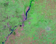


The map above is a Landsat satellite image of Illinois with County boundaries superimposed. We have a more detailed satellite image of Illinois without County boundaries.


ADVERTISEMENT
Illinois Counties and County Seats |
|
|
Adams County - Quincy Alexander County - Cairo Bond County - Greenville Boone County - Belvidere Brown County - Mount Sterling Bureau County - Princeton Calhoun County - Hardin Carroll County - Mount Carroll Cass County - Virginia Champaign County - Urbana Christian County - Taylorville Clark County - Marshall Clay County - Louisville Clinton County - Carlyle Coles County - Charleston Cook County - Chicago Crawford County - Robinson Cumberland County - Toledo De Witt County - Clinton DeKalb County - Sycamore Douglas County - Tuscola DuPage County - Wheaton Edgar County - Paris Edwards County - Albion Effingham County - Effingham Fayette County - Vandalia Ford County - Paxton Franklin County - Benton Fulton County - Lewistown Gallatin County - Shawneetown Greene County - Carrollton Grundy County - Morris Hamilton County - McLeansboro Hancock County - Carthage Hardin County - Elizabethtown Henderson County - Oquawka Henry County - Cambridge Iroquois County - Watseka Jackson County - Murphysboro Jasper County - Newton Jefferson County - Mount Vernon Jersey County - Jerseyville Jo Daviess County - Galena Johnson County - Vienna Kane County - Geneva Kankakee County - Kankakee Kendall County - Yorkville Knox County - Galesburg La Salle County - Ottawa Lake County - Waukegan Lawrence County - Lawrenceville |
Lee County - Dixon Livingston County - Pontiac Logan County - Lincoln Macon County - Decatur Macoupin County - Carlinville Madison County - Edwardsville Marion County - Salem Marshall County - Lacon Mason County - Havana Massac County - Metropolis McDonough County - Macomb McHenry County - Woodstock McLean County - Bloomington Menard County - Petersburg Mercer County - Aledo Monroe County - Waterloo Montgomery County - Hillsboro Morgan County - Jacksonville Moultrie County - Sullivan Ogle County - Oregon Peoria County - Peoria Perry County - Pinckneyville Piatt County - Monticello Pike County - Pittsfield Pope County - Golconda Pulaski County - Mound City Putnam County - Hennepin Randolph County - Chester Richland County - Olney Rock Island County - Rock Island Saline County - Harrisburg Sangamon County - Springfield Schuyler County - Rushville Scott County - Winchester Shelby County - Shelbyville St. Clair County - Belleville Stark County - Toulon Stephenson County - Freeport Tazewell County - Pekin Union County - Jonesboro Vermilion County - Danville Wabash County - Mount Carmel Warren County - Monmouth Washington County - Nashville Wayne County - Fairfield White County - Carmi Whiteside County - Morrison Will County - Joliet Williamson County - Marion Winnebago County - Rockford Woodford County - Eureka |
