Home » US Maps » Wisconsin » County Map
Wisconsin County Map with County Seat Cities

ADVERTISEMENT
County Maps for Neighboring States:
Illinois Iowa Michigan Minnesota


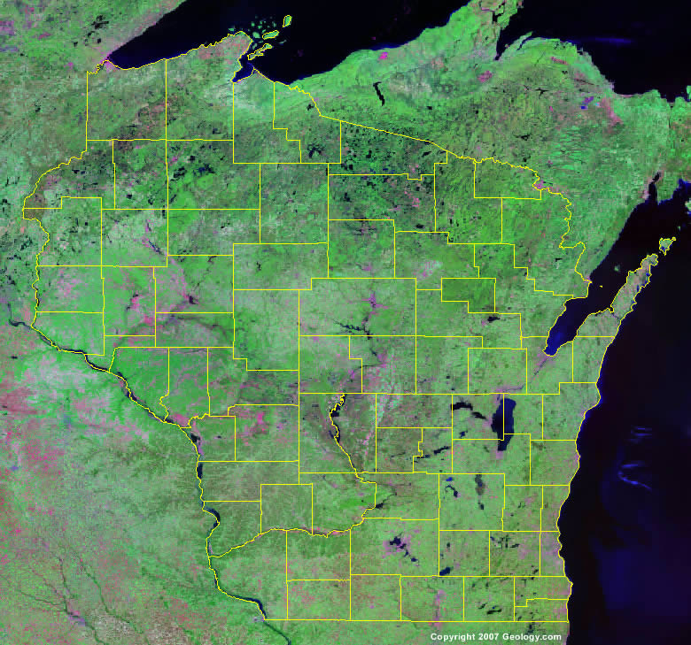
The map above is a Landsat satellite image of Wisconsin with County boundaries superimposed. We have a more detailed satellite image of Wisconsin without County boundaries.


ADVERTISEMENT
Wisconsin Counties and County Seats |
|
|
Adams County - Friendship Ashland County - Ashland Barron County - Barron Bayfield County - Washburn Brown County - Green Bay Buffalo County - Alma Burnett County - Siren Calumet County - Chilton Chippewa County - Chippewa Falls Clark County - Neillsville Columbia County - Portage Crawford County - Prairie du Chien Dane County - Madison Dodge County - Juneau Door County - Sturgeon Bay Douglas County - Superior Dunn County - Menomonie Eau Claire County - Eau Claire Florence County - Florence Fond du Lac County - Fond du Lac Forest County - Crandon Grant County - Lancaster Green County - Monroe Green Lake County - Green Lake Iowa County - Dodgeville Iron County - Hurley Jackson County - Black River Falls Jefferson County - Jefferson Juneau County - Mauston Kenosha County - Kenosha Kewaunee County - Kewaunee La Crosse County - La Crosse Lafayette County - Darlington Langlade County - Antigo Lincoln County - Merrill Manitowoc County - Manitowoc |
Marathon County - Wausau Marinette County - Marinette Marquette County - Montello Menominee County - Keshena Milwaukee County - Milwaukee Monroe County - Sparta Oconto County - Oconto Oneida County - Rhinelander Outagamie County - Appleton Ozaukee County - Port Washington Pepin County - Durand Pierce County - Ellsworth Polk County - Balsam Lake Portage County - Stevens Point Price County - Phillips Racine County - Racine Richland County - Richland Center Rock County - Janesville Rusk County - Ladysmith Sauk County - Baraboo Sawyer County - Hayward Shawano County - Shawano Sheboygan County - Sheboygan St. Croix County - Hudson Taylor County - Medford Trempealeau County - Whitehall Vernon County - Viroqua Vilas County - Eagle River Walworth County - Elkhorn Washburn County - Shell Lake Washington County - West Bend Waukesha County - Waukesha Waupaca County - Waupaca Waushara County - Wautoma Winnebago County - Oshkosh Wood County - Wisconsin Rapids |
