Home » US Maps » North Carolina » County Map
North Carolina County Map with County Seat Cities

ADVERTISEMENT
County Maps for Neighboring States:
Georgia South Carolina Tennessee Virginia
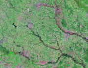


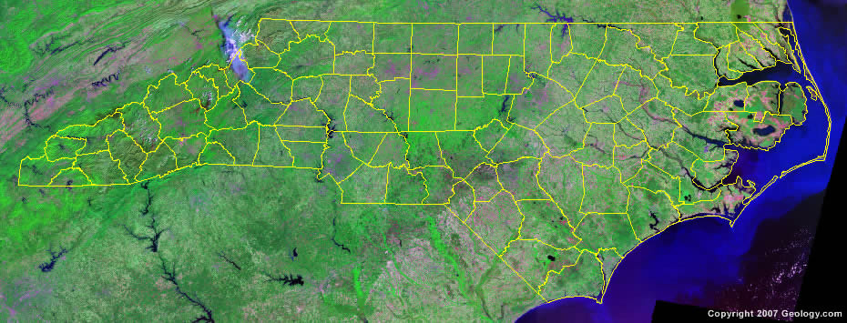
The map above is a Landsat satellite image of North Carolina with County boundaries superimposed. We have a more detailed satellite image of North Carolina without County boundaries.


ADVERTISEMENT
North Carolina Counties and County Seats |
|
|
Alamance County - Graham Alexander County - Taylorsville Alleghany County - Sparta Anson County - Wadesboro Ashe County - Jefferson Avery County - Newland Beaufort County - Washington Bertie County - Windsor Bladen County - Elizabethtown Brunswick County - Bolivia Buncombe County - Asheville Burke County - Morganton Cabarrus County - Concord Caldwell County - Lenoir Camden County - Camden Carteret County - Beaufort Caswell County - Yanceyville Catawba County - Newton Chatham County - Pittsboro Cherokee County - Murphy Chowan County - Edenton Clay County - Hayesville Cleveland County - Shelby Columbus County - Whiteville Craven County - New Bern Cumberland County - Fayetteville Currituck County - Currituck Dare County - Manteo Davidson County - Lexington Davie County - Mocksville Duplin County - Kenansville Durham County - Durham Edgecombe County - Tarboro Forsyth County - Winston-Salem Franklin County - Louisburg Gaston County - Gastonia Gates County - Gatesville Graham County - Robbinsville Granville County - Oxford Greene County - Snow Hill Guilford County - Greensboro Halifax County - Halifax Harnett County - Lillington Haywood County - Waynesville Henderson County - Hendersonville Hertford County - Winton Hoke County - Raeford Hyde County - Swan Quarter Iredell County - Statesville Jackson County - Sylva |
Johnston County - Smithfield Jones County - Trenton Lee County - Sanford Lenoir County - Kinston Lincoln County - Lincolnton Macon County - Franklin Madison County - Marshall Martin County - Williamston McDowell County - Marion Mecklenburg County - Charlotte Mitchell County - Bakersville Montgomery County - Troy Moore County - Carthage Nash County - Nashville New Hanover County - Wilmington Northampton County - Jackson Onslow County - Jacksonville Orange County - Hillsborough Pamlico County - Bayboro Pasquotank County - Elizabeth City Pender County - Burgaw Perquimans County - Hertford Person County - Roxboro Pitt County - Greenville Polk County - Columbus Randolph County - Asheboro Richmond County - Rockingham Robeson County - Lumberton Rockingham County - Wentworth Rowan County - Salisbury Rutherford County - Rutherfordton Sampson County - Clinton Scotland County - Laurinburg Stanly County - Albemarle Stokes County - Danbury Surry County - Dobson Swain County - Bryson City Transylvania County - Brevard Tyrrell County - Columbia Union County - Monroe Vance County - Henderson Wake County - Raleigh Warren County - Warrenton Washington County - Plymouth Watauga County - Boone Wayne County - Goldsboro Wilkes County - Wilkesboro Wilson County - Wilson Yadkin County - Yadkinville Yancey County - Burnsville |
