Home » US Maps » Mississippi » County Map
Mississippi County Map with County Seat Cities

ADVERTISEMENT
County Maps for Neighboring States:
Alabama Arkansas Louisiana Tennessee


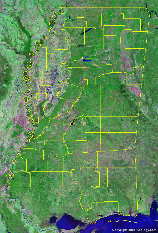
The map above is a Landsat satellite image of Mississippi with County boundaries superimposed. We have a more detailed satellite image of Mississippi without County boundaries.


ADVERTISEMENT
Mississippi Counties and County Seats |
|
|
Adams County - Natchez Alcorn County - Corinth Amite County - Liberty Attalla County - Kosciusko Benton County - Ashland Bolivar County - Rosedale and Cleveland Calhoun County - Pittsboro Carroll County - Vaiden and Carrollton Chickasaw County - Houston and Okolona Choctaw County - Ackerman Claiborne County - Port Gibson Clarke County - Quitman Clay County - West Point Coahoma County - Clarksdale Copiah County - Hazlehurst Covington County - Collins DeSoto County - Hernando Forrest County - Hattiesburg Franklin County - Meadville George County - Lucedale Greene County - Leakesville Grenada County - Grenada Hancock County - Bay St. Louis Harrison County - Gulfport Hinds County - Raymond and Jackson Holmes County - Lexington Humphreys County - Belzoni Issaquena County - Mayersville Itawamba County - Fulton Jackson County - Pascagoula Jasper County - Bay Springs and Paulding Jefferson County - Fayette Jefferson Davis County - Prentiss Jones County - Laurel and Ellisville Kemper County - De Kalb Lafayette County - Oxford Lamar County - Purvis Lauderdale County - Meridian Lawrence County - Monticello Leake County - Carthage Lee County - Tupelo |
Leflore County - Greenwood Lincoln County - Brookhaven Lowndes County - Columbus Madison County - Canton Marion County - Columbia Marshall County - Holly Springs Monroe County - Aberdeen Montgomery County - Winona Neshoba County - Philadelphia Newton County - Decatur Noxubee County - Macon Oktibbeha County - Starkville Panola County - Batesville and Sardis Pearl River County - Poplarville Perry County - New Augusta Pike County - Magnolia Pontotoc County - Pontotoc Prentiss County - Booneville Quitman County - Marks Rankin County - Brandon Scott County - Forest Sharkey County - Rolling Fork Simpson County - Mendenhall Smith County - Raleigh Stone County - Wiggins Sunflower County - Indianola Tallahatchie County - Charleston and Sumner Tate County - Senatobia Tippah County - Ripley Tishomingo County - Iuka Tunica County - Tunica Union County - New Albany Walthall County - Tylertown Warren County - Vicksburg Washington County - Greenville Wayne County - Waynesboro Webster County - Walthall Wilkinson County - Woodville Winston County - Louisville Yalobusha County - Coffeeville and Water Valley Yazoo County - Yazoo City |
