Home » US Maps » Iowa » Lakes and Rivers
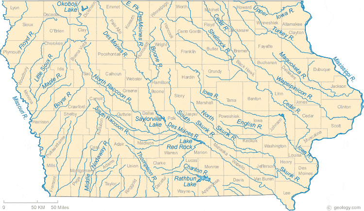
Iowa Lakes, Rivers and Water Resources
ADVERTISEMENT
Iowa Rivers Shown on the Map: Boone River, Boyer River, Cedar River, Chariton River, Des Moines River, East Fork Des Moines River, English River, Floyd River, Iowa River, Little Sioux River, Maple River, Maquoketa River, Middle Nodaway River, Mississippi River, Missouri River, North Raccoon River, North Skunk River, Shellrock River, Skunk River, South Raccoon River, South Skunk River, Thompson River, Turkey River, Upper Iowa River and Wapsipinicon River.
Iowa Lakes Shown on the Map: Lake Red Rock, Okoboji Lake, Rathbun Lake and Saylorville Lake.
| Iowa Stream and River Levels |
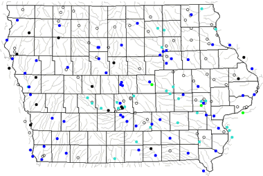 The United States Geological Survey has a number of stream gages located throughout Iowa. These estimate stream levels, discharges and record them over time. This data is published on the web and many stations allow users to plot custom graphs. Get updated Iowa river and stream levels from USGS here.
| Iowa Stream and River Level Alerts |
 The United States Geological Survey has a system that will send you an email message when flood levels are reached on any stream with USGS gaging equipment that you have selected. Sign up here to receive Iowa stream and river level alerts.

| Iowa Drought Map |
 The United States Geological Survey publishes updated drought maps on their website. There you can view a map that shows where below normal 7-day average stream flow conditions were recently recorded. The maps are updated daily. Get a current Iowa drought map here.
| Iowa Water Publications |
 The United States Geological Survey has a number of publications related to water use and water resources in Iowa. Visit the Central Midwest Water Science Center here.
| Iowa Elevation Map |
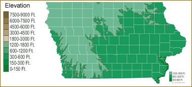 The topography of an area determines the direction of stream flow and often is a primary influence on the geographic distribution of precipitation. View a detailed Iowa elevation map.


Find Other Topics on Geology.com:

|

| ||

|

| ||

|

| ||

|

|