Home » US Maps » New Hampshire » Lakes and Rivers
New Hampshire Lakes, Rivers and Water Resources

ADVERTISEMENT
New Hampshire Rivers Shown on the Map: Ammonoosuc River, Androscoggin River, Ashuelot River, Connecticut River, Contoocook River, Merrimack River, Pemigewasset River, Salmon Falls River, Souhegan River, Suncook River and Upper Ammonoosuc River.
New Hampshire Lakes Shown on the Map: First Connecticut Lake, Lake Francis, Lake Winnipesaukee, Moore Reservoir, Newfound Lake, Ossipee Lake, Second Connecticut Lake, Sunapee Lake, Umbagog Lake and Winnisquam Lake.
| New Hampshire Elevation Map |
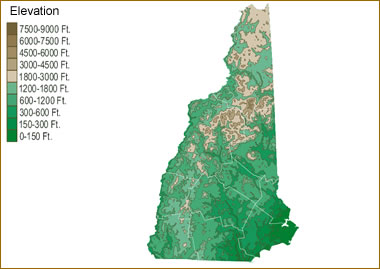 The topography of an area determines the direction of stream flow and often is a primary influence on the geographic distribution of precipitation. View a detailed New Hampshire elevation map.
| New Hampshire Stream and River Levels |
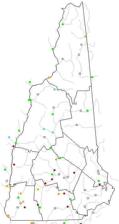 The United States Geological Survey has a number of stream gages located throughout New Hampshire. These estimate stream levels, discharges and record them over time. This data is published on the web and many stations allow users to plot custom graphs. Get updated New Hampshire river and stream levels from USGS here.
| New Hampshire Stream and River Level Alerts |
 The United States Geological Survey has a system that will send you an email message when flood levels are reached on any steam with USGS gaging equipment that you have selected. Sign up here to recieve New Hampshire stream and river level alerts.

| New Hampshire Waterfall: Arethusa Falls |
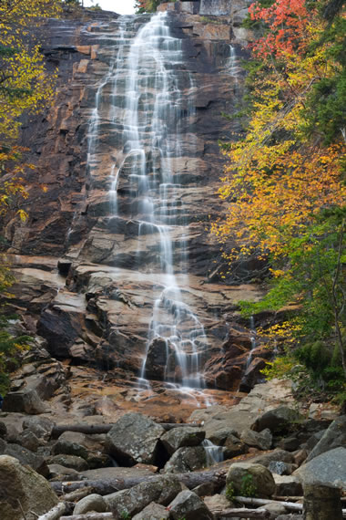 Arethusa Falls is located in Crawford Notch State Park in the White Mountains of Grafton County, New Hampshire. It is the highest waterfall in the state with a height of about 140 feet. At Crawford Notch, Bemis Brook spills over a granite cliff to create this horsetail waterfall. Image copyright by iStockphoto / ScottOrr.
| New Hampshire Drought Map |
 The United States Geological Survey publishes updated drought maps on their website. There you can view a map that shows where below normal 7-day average stream flow conditions were recently recorded. The maps are updated daily. Get a current New Hampshire drought map here.
| New Hampshire Water Publications |
 The United States Geological Survey has a number of publications related to water use and water resources in New Hampshire. Visit the New England Water Science Center here.


Find Other Topics on Geology.com:

|

| ||

|

| ||

|

| ||

|

|