Home » US Maps » South Dakota » Lakes and Rivers
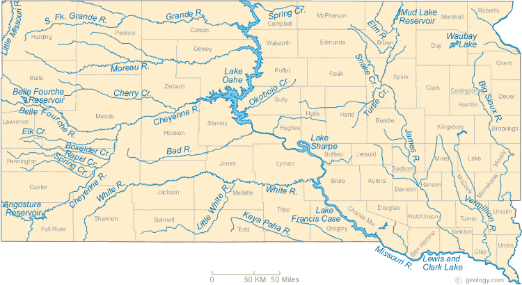
South Dakota Lakes, Rivers and Water Resources
ADVERTISEMENT
South Dakota Rivers Shown on the Map: Bad River, Belle Gourcher River, Big Sioux River, Boxelder Creek, Cherry Creek, Cheyenne River, Elk Creek, Elm River, Grande River, James River, Keya Paha River, Little Missouri River, Little White River, Missouri River, Moreau River, Okobojo Creek, Rapid Creek, Snake Creek, South Fork Grande River, Spring Creek, Turtle Creek, Vermillion River and White River.
South Dakota Lakes Shown on the Map: Angostura Reservoir, Belle Fourche Reservoir, Lake Francis Case, Lake Oahe, Lake Sharpe, Lewis and Clark Lake, Mud Lake Reservoir and Waubay Lake.
| South Dakota Stream and River Levels |
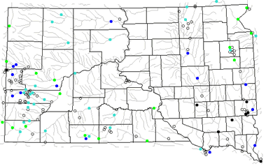 The United States Geological Survey has a number of stream gages located throughout South Dakota. These estimate stream levels, discharges and record them over time. This data is published on the web and many stations allow users to plot custom graphs. Get updated South Dakota river and stream levels from USGS here.
| South Dakota Stream and River Level Alerts |
 The United States Geological Survey has a system that will send you an email message when flood levels are reached on any steam with USGS gaging equipment that you have selected. Sign up here to recieve South Dakota stream and river level alerts.

| South Dakota Drought Map |
 The United States Geological Survey publishes updated drought maps on their website. There you can view a map that shows where below normal 7-day average stream flow conditions were recently recorded. The maps are updated daily. Get a current South Dakota drought map here.
| South Dakota Water Publications |
 The United States Geological Survey has a number of publications related to water use and water resources in South Dakota. Visit the Dakota Water Science Center here.
| South Dakota Elevation Map |
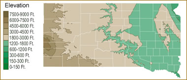 The topography of an area determines the direction of stream flow and often is a primary influence on the geographic distribution of precipitation. View a detailed South Dakota elevation map.


Find Other Topics on Geology.com:

|

| ||

|

| ||

|

| ||

|

|