Home » Satellite Images » US States » Maine
Satellite Image of Maine
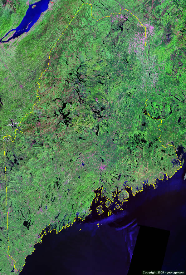
Maine Satellite Image - View Cities, Rivers, Lakes & Environment
Satellite Images for Neighboring States:
New Hampshire VermontThis is a Landsat GeoCover 2000 satellite image map of Maine. Cities, rivers, lakes, mountains and other features shown in this image include:
Maine Cities:
Augusta, ME
Bangor, ME
Bar Harbor, ME
Brunswick, ME
Biddeford, ME
Caribou, ME
Kennebunk, ME
Lewiston, ME
Portland, ME
Presque Isle, ME
Rockland, ME
St. Agatha, ME
Maine Rivers, Lakes, Water Features:
Androscoggin River
Big Lake
Brassua Lake
Chamberlain Lake
Chesuncook Lake
Cross Lake
Eagle Lake
Fish River Lake
Flagstaff Lake
Graham Lake
Grand Lake Matagamon
Great Pond
Long Lake
Kennebec River
Mattawamkeag Lake
Millinocket Lake
Moosehead Lake
Nicatous Lake
Pemadumcook Lake
Penobscot River
Pleasant Lake
Richardson Lake
Schoodic Lake
Sebago Lake
Seboeis Lake
Squapan Lake
Square Lake
St. Froid Lake
St. John River
Other Prominent Maine Features:
Appalachian Mountains
Penobscot Bay
White Mountains
ADVERTISEMENT
More Satellite Images
 State Satellite Images: Color Landsat views of all 50 states. Spectacular images.
 Use Google Earth for FREE: Browse seamless worldwide satellite images. Free.
 Earth from Space at Night: Composite images show worldwide patterns of night light and heat.
 Oil & Gas Fields from Space at Night: Drill pad lighting and flaring make them stand out at night.
 Country Satellite Images: Satellite images for over 170 countries from Landsat GeoCover data.
  Satellite Views of US Cities: Images of 120 cities and their surrounding environment.
 Land Below Sea Level: The top ten locations where land is below the level of the ocean.
  Satellite Views of 64 World Cities: Spectacular images showing the city and surrounding environment.
Copyright information: The images on this page were composed by Angela King and are copyright by Geology.com. These images are not available for use beyond our websites. If you would like to share them with others, please link to this page. The satellite image was produced using Landsat data from NASA.