Idaho Map Collection
Idaho County Map:
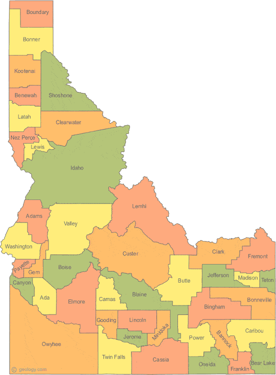
This map shows Idaho's 44 counties. Also available is a detailed Idaho County Map with county seat cities.
ADVERTISEMENT


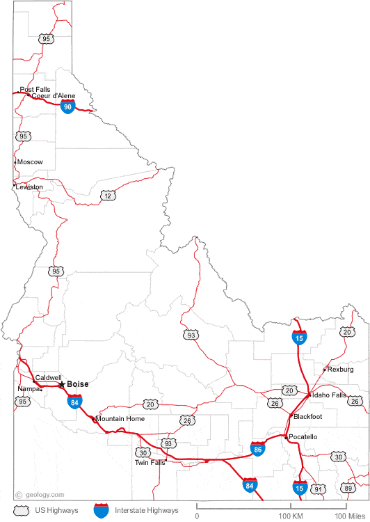
Map of Idaho Cities:
This map shows many of Idaho's important cities and most important roads. The important north - south route is Interstate 15. Important east - west routes include: Interstate 84, Interstate 86 and Interstate 90. We also have a more detailed Map of Idaho Cities.
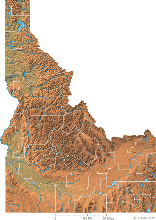
Idaho Physical Map:
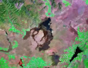
This Idaho shaded relief map shows the major physical features of the state. For other nice views of the state, see our Idaho Satellite image or the Idaho map by Google.
ADVERTISEMENT

Idaho Rivers Map:
This map shows the major streams and rivers of Idaho and some of the larger lakes. Most of Idaho is in the Pacific Ocean Watershed and most of the drainage leaves the state through the Snake, Salmon, Clearwater, and St. Joe Rivers. Small areas of southern Idaho are in the Great Basin, one of a few areas of the United States that does not drain into an ocean. Most of these lakes and streams can be clearly seen on the Idaho Satellite Image. We also have a page about Idaho water resources.
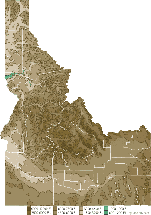
Idaho Elevation Map:
This is a generalized topographic map of Idaho. It shows elevation trends across the state. Detailed topographic maps and aerial photos of Idaho are available in the Geology.com store. See our state high points map to learn about Borah Peak at 12,662 feet - the highest point in Idaho. The lowest point is the Snake River at 710 feet.