Home » US Maps » Minnesota Maps
Minnesota Map Collection
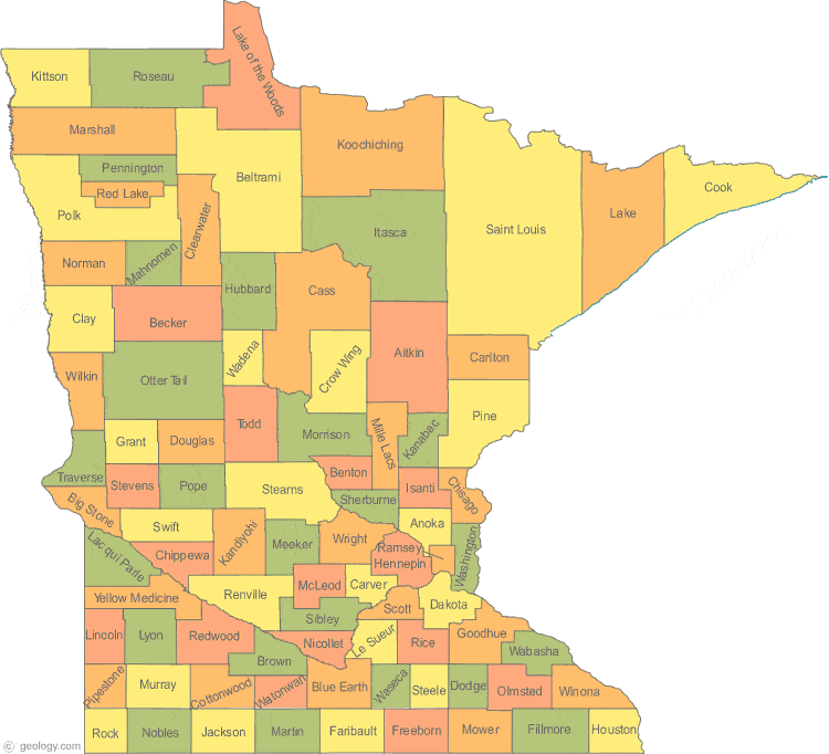
Minnesota County Map:
This map shows Minnesota's 87 counties. Also available is a detailed Minnesota County Map with county seat cities.
ADVERTISEMENT


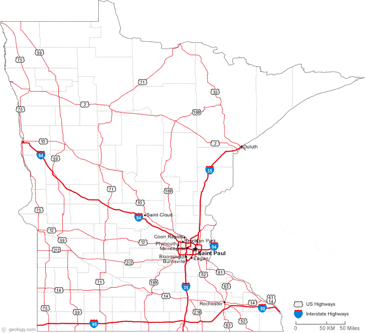
Map of Minnesota Cities:
This map shows many of Minnesota's important cities and most important roads. The important north - south route is Interstate 35. Important east - west routes include: Interstate 90 and Interstate 94. We also have a more detailed Map of Minnesota Cities.
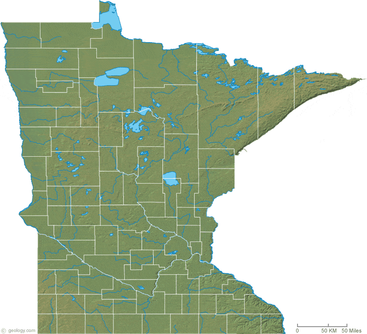
Minnesota Physical Map:
This Minnesota shaded relief map shows the major physical features of the state. For other nice views of the state, see our Minnesota Satellite image or the Minnesota map by Google.
ADVERTISEMENT
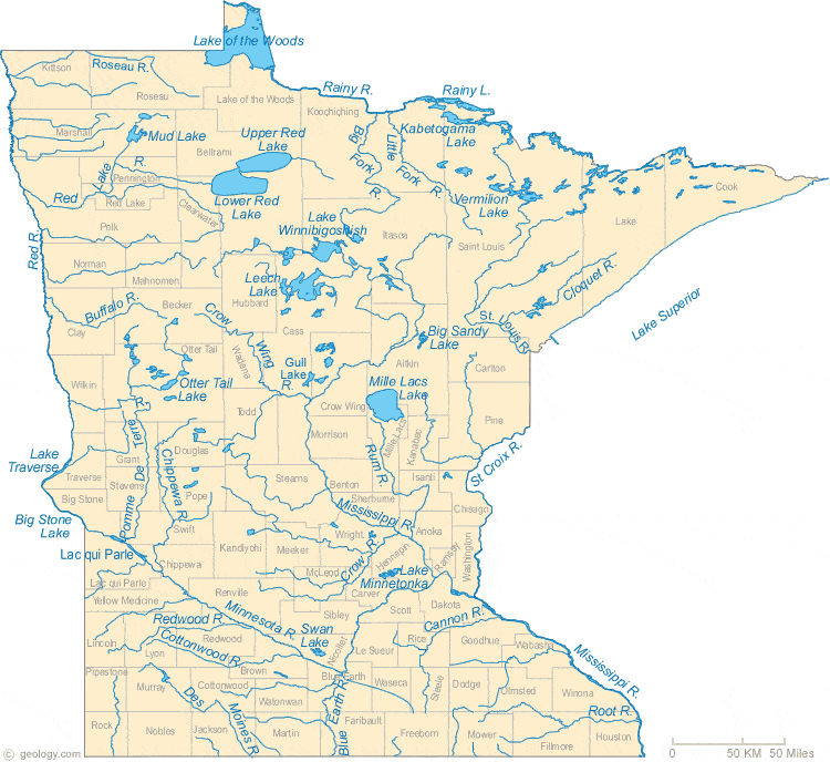
Minnesota Rivers Map:
This map shows the major streams and rivers of Minnesota and some of the larger lakes. Two major drainage divides cross the state, the St. Lawrence Seaway Divide and the Northern Continental Divide. Streams in the northern portion of the state are in the Arctic Ocean Watershed. A small area in the northeastern part of the state is within the St. Lawrence Watershed and drains into Lake Superior. The remainder of the state is in the Gulf of America Watershed. Most of the drainage there leaves the state through the Mississippi River. A "triple point" exists near Hibbing, Minnesota. Here the Northern Divide intersects the Great Continental Divide and drainage around the triple point flows into three different major watersheds. Native Americans understood the significance of this location and held council meetings there. Most of these lakes and streams can be clearly seen on the Minnesota Satellite Image. We also have a page about Minnesota water resources.
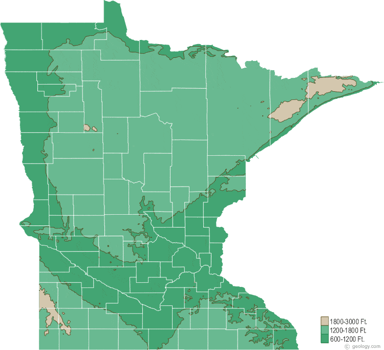
Minnesota Elevation Map:
This is a generalized topographic map of Minnesota. It shows elevation trends across the state. Detailed topographic maps and aerial photos of Minnesota are available in the Geology.com store. See our state high points map to learn about Eagle Mtn. at 2,301 feet - the highest point in Minnesota. The lowest point is Lake Superior at 601 feet.