Home » World Maps » Europe » Albania
Albania Map and Satellite Image

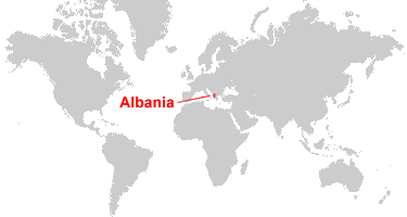
| Albania is located in southeastern Europe. Albania is bordered by the Adriatic Sea to the west, Montenegro to the northwest, Kosovo to the northeast, the Republic of North Macedonia to the east, and Greece to the south. |
ADVERTISEMENT
Albania Bordering Countries:
Greece, Kosovo, Montenegro, and Republic of North Macedonia.Regional Maps:
Map of Europe, World MapWhere is Albania?
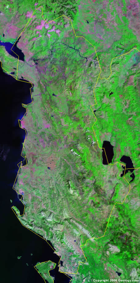
Albania Satellite Image
ADVERTISEMENT

Explore Albania Using Google Earth:
Google Earth is a free program from Google that allows you to explore satellite images showing the cities and landscapes of Albania and all of Europe in fantastic detail. It works on your desktop computer, tablet, or mobile phone. The images in many areas are detailed enough that you can see houses, vehicles and even people on a city street. Google Earth is free and easy-to-use.
Albania on a World Wall Map:
Albania is one of nearly 200 countries illustrated on our Blue Ocean Laminated Map of the World. This map shows a combination of political and physical features. It includes country boundaries, major cities, major mountains in shaded relief, ocean depth in blue color gradient, along with many other features. This is a great map for students, schools, offices and anywhere that a nice map of the world is needed for education, display or decor.
Albania On a Large Wall Map of Europe:
If you are interested in Albania and the geography of Europe our large laminated map of Europe might be just what you need. It is a large political map of Europe that also shows many of the continent's physical features in color or shaded relief. Major lakes, rivers,cities, roads, country boundaries, coastlines and surrounding islands are all shown on the map.Albania Cities:
Bajze, Berat, Borsh, Bushtrice, Celeb, Cerave, Covorode, Divjake, Dukat, Durres, Elbasan, Fier, Fier-Shegan, Gjirokaster (Argyrus), Iballe, Jergocat, Karavasta, Kavaje, Konispol, Koplik, Korce, Krume, Lezhe, Lushnje, Mamuras, Obot, Peshkopi, Pulaj, Sarande, Shegan, Shkoder (Scutari), Tepelene, Tirane (Tirana), Tropoje, Vermosh and Vlore (Valona).Albania Locations:
Adriatic Sea, Aegean Sea, Bune River, Drin River, Drini Zi River, Gjiri i Drinit, Gjiri i Durresit, Gjiri i Lalezit, Gjiri i Vlores, Gulf of Taranto, Ionian Sea, Keneta a Terbufit, Kiri River, Laguna e Karavastase, Laguna e Nartes, Limni Mikri Prespa, Liqeni i Butrintit, North Albanian Alps, Ohridsko Jezero (Lake Ohritl), Pindus Mountains, Prespansko Jezero (Lake Prespa), Seman River, Skadarsko Jezero (Lake Scutari) and Strait of Ortranto.Albania Natural Resources:
Albania has fossil fuel resources of oil, natural gas and coal in commercial quantities. Metal resources include chromite, copper, iron ore and nickel. Other resources include salt, timber and hydropower.Albania Natural Hazards:
Albania has natural hazards, such as floods, drought and destructive earthquakes. There are also tsunamis which occur along the southwestern coast of the country.Albania Environmental Issues:
An environmental issue for Albania is water pollution, stemming from both industrial and domestic activities. The country also has problems with soil erosion and deforestation.
ADVERTISEMENT