Home » World Maps » Arctic Ocean Bathymetry Map
Arctic Ocean Bathymetry Map
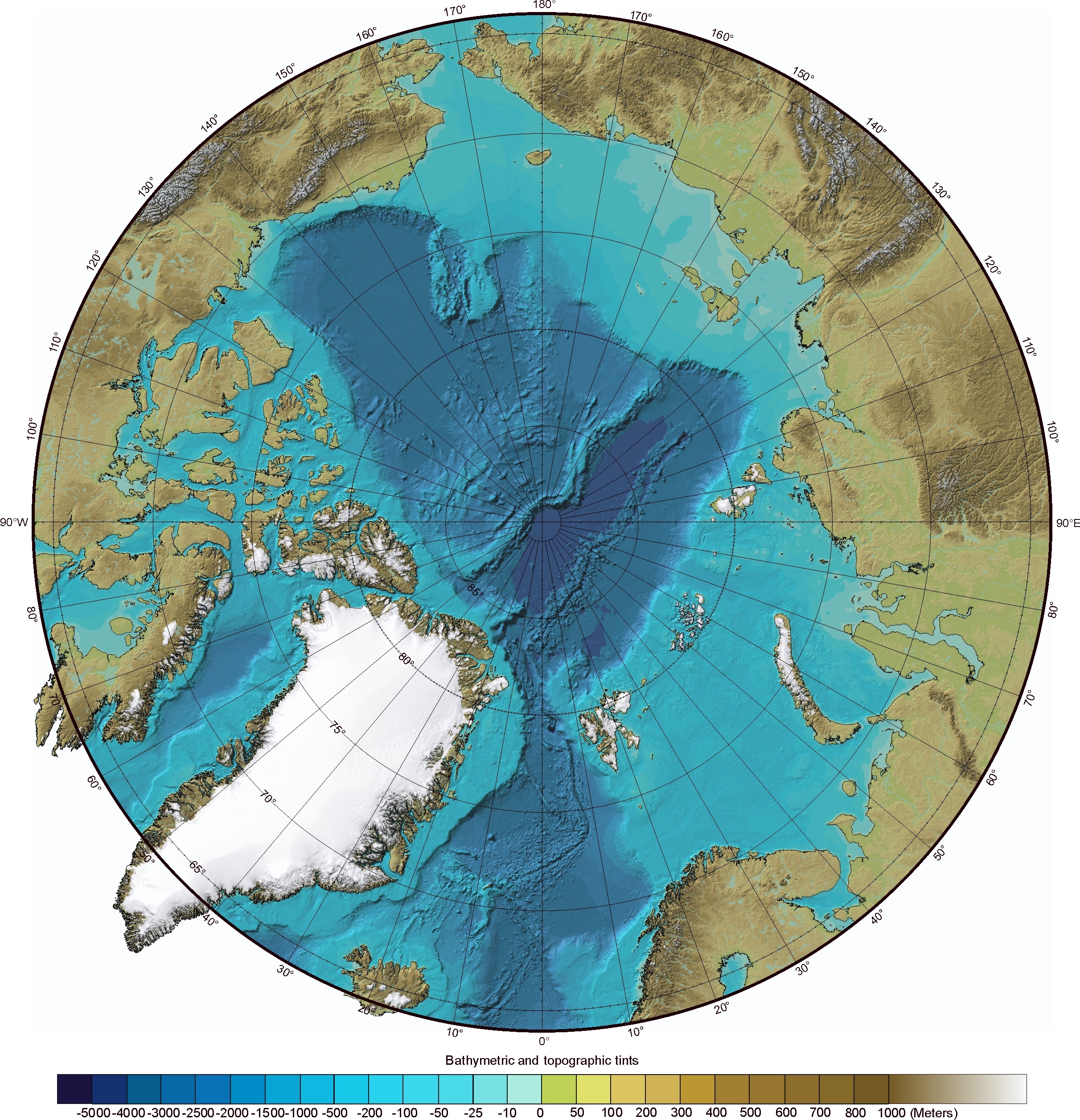
Arctic Ocean Bathymetry Map:
Shown above is the International Bathymetric Chart of the Arctic Ocean which was produced by a team of investigators from Canada, Denmark, Germany, Iceland, Norway, Russia, Sweden, and the USA. It can be considered a "physical map of the Arctic Ocean" as it shows the bathymetry, ridges, and basins that are part of this important area. Click to enlarge.The International Bathymetric Chart of the Arctic Ocean was produced by investigators representing the Intergovernmental Oceanographic Commission (IOC), the International Arctic Science Committee (IASC), the International Hydrographic Organization (IHO), the US Office of Naval Research (ONR), and the US National Geophysical Data Center (NGDC).
To learn more about this map and the Arctic Ocean, please visit our article about Arctic Ocean Seafloor Features.

ADVERTISEMENT