Home » World Maps » Asia » Brunei
Brunei Map and Satellite Image
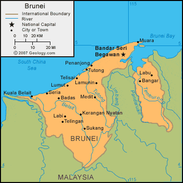
| Brunei is located in southeastern Asia, on the island of Borneo. Brunei is bordered by the South China Sea to the north, and Malaysia to the south, east, and west. |
ADVERTISEMENT
Brunei Bordering Countries:
MalaysiaRegional Maps:
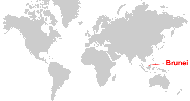
Map of Asia, World MapWhere is Brunei?
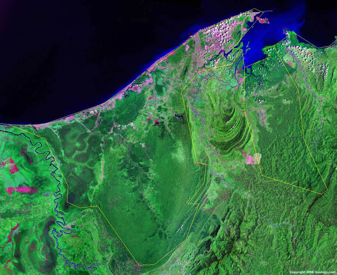
Brunei Satellite Image
ADVERTISEMENT

Explore Brunei Using Google Earth:
Google Earth is a free program from Google that allows you to explore satellite images showing the cities and landscapes of Brunei and all of Asia in fantastic detail. It works on your desktop computer, tablet, or mobile phone. The images in many areas are detailed enough that you can see houses, vehicles and even people on a city street. Google Earth is free and easy-to-use.
Brunei on a World Wall Map:
Brunei is one of nearly 200 countries illustrated on our Blue Ocean Laminated Map of the World. This map shows a combination of political and physical features. It includes country boundaries, major cities, major mountains in shaded relief, ocean depth in blue color gradient, along with many other features. This is a great map for students, schools, offices and anywhere that a nice map of the world is needed for education, display or decor.
Brunei On a Large Wall Map of Asia:
If you are interested in Brunei and the geography of Asia our large laminated map of Asia might be just what you need. It is a large political map of Asia that also shows many of the continent's physical features in color or shaded relief. Major lakes, rivers, cities, roads, country boundaries, coastlines and surrounding islands are all shown on the map.Brunei Cities:
Badas, Bandar Seri Begawan, Bangar, Kerangan Nyatan, Kuala Abang, Kuala Belait, Labi, Labu, Lamunin, Lumut, Medit, Muara, Penanjong, Seria, Sukang, Telingan, Telisai and Tutong.Brunei Locations:
Belait River, Brunei Bay, Panderuan River, South China Sea, Temburong River and Tutong River.Brunei Natural Resources:
Brunei's natural resouces include timber, natural gas, and petroleum.Brunei Natural Hazards:
Although rare, Brunei does experience occasional earthquakes, typhoons, and severe flooding.Brunei Environmental Issues:
Forest fires in Indonesia cause seasonal smoke and/or haze.
ADVERTISEMENT