Home » World Maps » Europe » Finland
Finland Map and Satellite Image
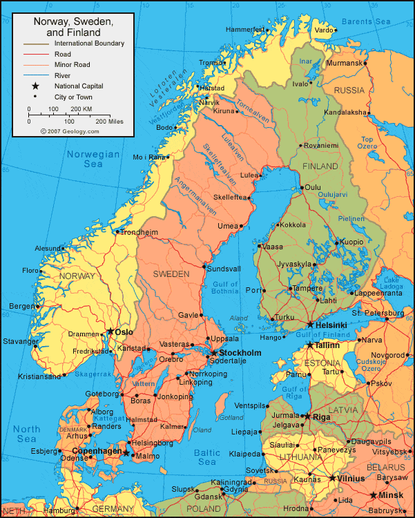
| Finland is located in northern Europe. Finland is bordered by the Baltic Sea, Gulf of Finland, and Gulf of Bothnia, with Sweden to the west, Russia to the east, and Norway to the north. |
ADVERTISEMENT
Finland Bordering Countries:
Norway, Sweden, RussiaRegional Maps:
Map of Europe, World Map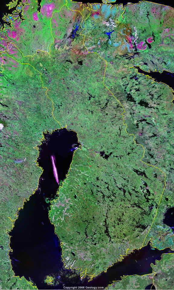
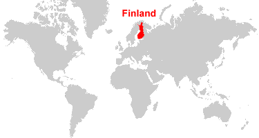
Where is Finland?

Explore Finland Using Google Earth:
Google Earth is a free program from Google that allows you to explore satellite images showing the cities and landscapes of Finland and all of Europe in fantastic detail. It works on your desktop computer, tablet, or mobile phone. The images in many areas are detailed enough that you can see houses, vehicles and even people on a city street. Google Earth is free and easy-to-use.
Finland on a World Wall Map:
Finland is one of nearly 200 countries illustrated on our Blue Ocean Laminated Map of the World. This map shows a combination of political and physical features. It includes country boundaries, major cities, major mountains in shaded relief, ocean depth in blue color gradient, along with many other features. This is a great map for students, schools, offices and anywhere that a nice map of the world is needed for education, display or decor.
Finland On a Large Wall Map of Europe:
If you are interested in Finland and the geography of Europe our large laminated map of Europe might be just what you need. It is a large political map of Europe that also shows many of the continent's physical features in color or shaded relief. Major lakes, rivers,cities, roads, country boundaries, coastlines and surrounding islands are all shown on the map.ADVERTISEMENT
Finland Cities:
Espoo (Esbo), Hango (Hanko), Helsinki (Helsingfors), Ivalo, Jakobstad, Jyvaskyla, Kajaani, Kankaanpaa, Kemi, Kerava, Kokkola (Gamlakarleby), Kuopio, Lahti, Lappeenranta, Lieksa, Lohja, Mikkeli, Nokia, Oulu (Uleaborg), Pargas (Parainen), Pieksamaki, Pori, Raiso, Rauma, Rovaniemi, Salo, Savonlinna, Tampere, Turku (Abo), Uusikaupunki and Vaasa.Finland Locations:
Baltic Sea, Barents Sea, Gulf of Bothnia, Gulf of Finland, Inari, Isojarvi, Juojarvi, Kolimajarvi, Kyrosjarvi, Lake Ladoga, Lappajarvi, Miekojarvi, Muojarvi, Orivesi, Oulujarvi, Porttipahata Reservoir, Puhosjarvi, Pyhajarvi, Saimaa, Simojarvi and Vuotjarvi.Finland Natural Resources:
Metallic resources of Finland include chromite, copper, gold, iron ore, lead, silver, nickel and zinc. Other natural resources include limestone and timber.Finland Natural Hazards:
Finland can experience severe winters, especially in the northern part of the country.Finland Environmental Issues:
Environmental issues for Finland are mostly related to manufacturing and industry. The country's water pollution is from industrial wastes and agricultural chemicals. The country's air pollution is from manufacturing and power plants, which contributes to acid rain. The wildlife populations are threatened by habitat loss.
ADVERTISEMENT