Home » World Maps » Asia » China » Hong Kong
Hong Kong Map and Satellite Image
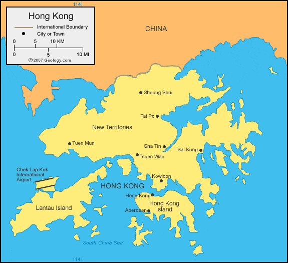
| Hong Kong is a collection of islands in the South China Sea, on the southeastern coast of China. Hong Kong is a Special Administrative Region of China. |
ADVERTISEMENT
Hong Kong Bordering Countries:
Hong Kong is a Special Administrative Region of China.Regional Maps:
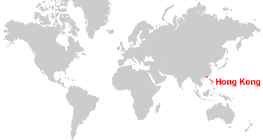
Map of China, Map of Asia, World MapWhere is Hong Kong?
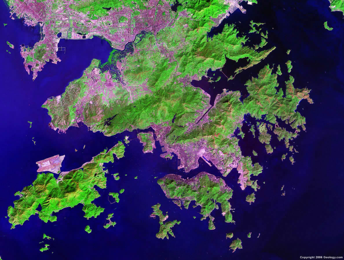
Hong Kong Satellite Image
ADVERTISEMENT

Explore Hong Kong Using Google Earth:
Google Earth is a free program from Google that allows you to explore satellite images showing the cities and landscapes of Hong Kong and all of Asia in fantastic detail. It works on your desktop computer, tablet, or mobile phone. The images in many areas are detailed enough that you can see houses, vehicles and even people on a city street. Google Earth is free and easy-to-use.
Hong Kong on a World Wall Map:
Hong Kong is included on our Blue Ocean Laminated Map of the World. This map shows a combination of political and physical features. It includes country boundaries, major cities, major mountains in shaded relief, ocean depth in blue color gradient, along with many other features. This is a great map for students, schools, offices and anywhere that a nice map of the world is needed for education, display or decor.
Hong Kong On a Large Wall Map of Asia:
If you are interested in Hong Kong and the geography of Asia, our large laminated map of Asia might be just what you need. It is a large political map of Asia that also shows many of the continent's physical features in color or shaded relief. Major lakes, rivers, cities, roads, country boundaries, coastlines and surrounding islands are all shown on the map.Hong Kong Natural Resources:
Hong Kong has an outstanding deepwater harbor as a natural resource. Another important resource is feldspar.Hong Kong Natural Hazards:
Hong Kong has natural hazards, which include the occasional typhoon.Hong Kong Environmental Issues:
Hong Kong's environmental issues include air and water pollution from rapid urbanization.
ADVERTISEMENT