Home » World Maps » Africa » Lesotho
Lesotho Map and Satellite Image
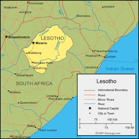
| Lesotho is located in southern Africa. Lesotho an enclave in South Africa, so it is bordered by South Africa to the north, south, east, and west. |
ADVERTISEMENT
Lesotho Bordering Countries:
South AfricaRegional Maps:
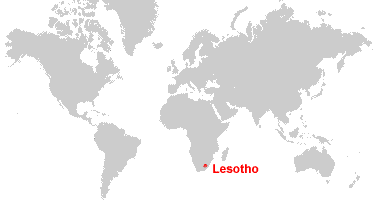
Map of Africa, World MapWhere is Lesotho?
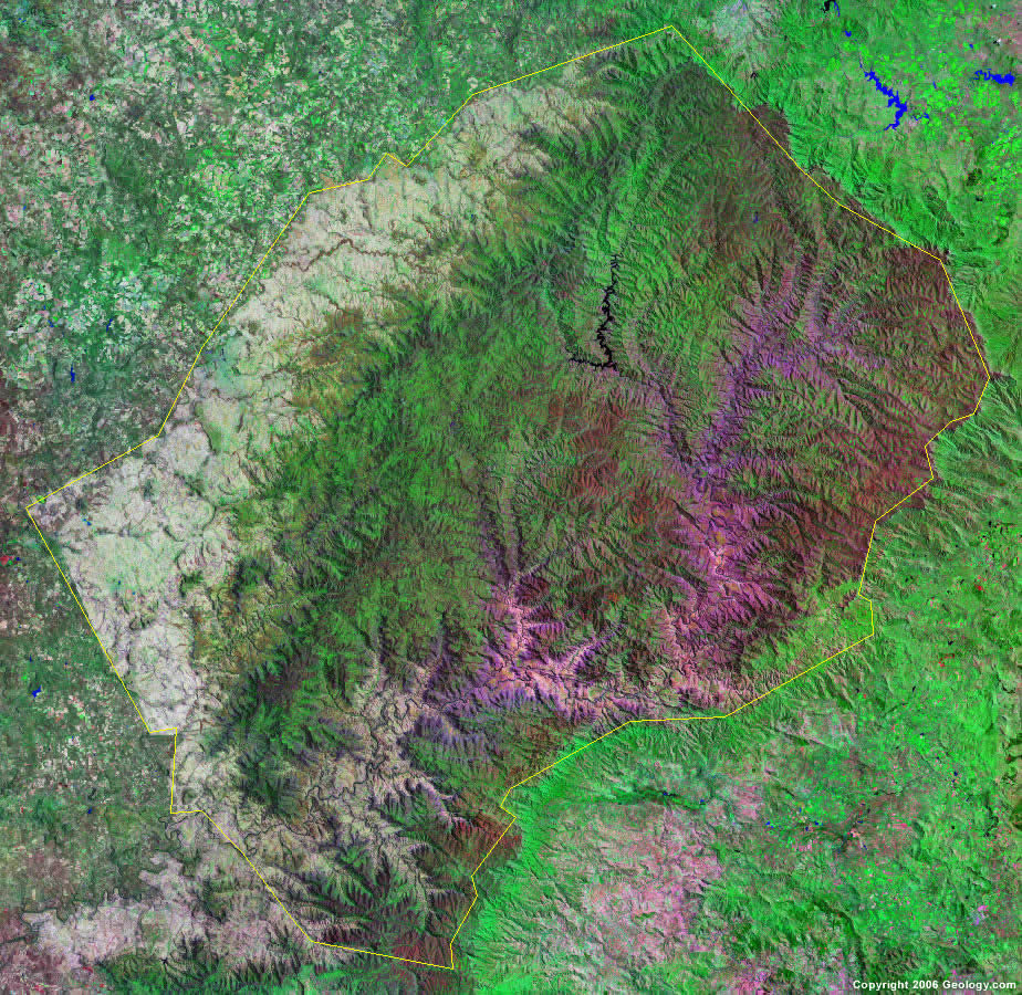
Lesotho Satellite Image
ADVERTISEMENT

Explore Lesotho Using Google Earth:
Google Earth is a free program from Google that allows you to explore satellite images showing the cities and landscapes of Lesotho and all of Africa in fantastic detail. It works on your desktop computer, tablet, or mobile phone. The images in many areas are detailed enough that you can see houses, vehicles and even people on a city street. Google Earth is free and easy-to-use.
Lesotho on a World Wall Map:
Lesotho is one of nearly 200 countries illustrated on our Blue Ocean Laminated Map of the World. This map shows a combination of political and physical features. It includes country boundaries, major cities, major mountains in shaded relief, ocean depth in blue color gradient, along with many other features. This is a great map for students, schools, offices and anywhere that a nice map of the world is needed for education, display or decor.
Lesotho On a Large Wall Map of Africa:
If you are interested in Lesotho and the geography of Africa our large laminated map of Africa might be just what you need. It is a large political map of Africa that also shows many of the continent's physical features in color or shaded relief. Major lakes, rivers, cities, roads, country boundaries, coastlines and surrounding islands are all shown on the map.Lesotho Cities:
Maseru, Mafeteng, Mohales Hoek, Quthing.Lesotho Locations:
Caledon River and Orange River.Lesotho Natural Resources:
Lesotho has commercial deposits of diamonds, clay, sand, and building stone. Other natural resources for this country are agricultural and grazing land. The Highlands Water Project provides hydroelectricity to Lesotho, and the country also controls, stores, and redirects water to South Africa.Lesotho Natural Hazards:
Lesotho has some natural hazards which include periodic droughts.Lesotho Environmental Issues:
The land-locked country of Lesotho has population pressures, which force settlement in marginal areas. The resulting environmental issues include: overgrazing; severe soil erosion; soil exhaustion; desertification.
ADVERTISEMENT