Home » World Maps » Europe » Moldova
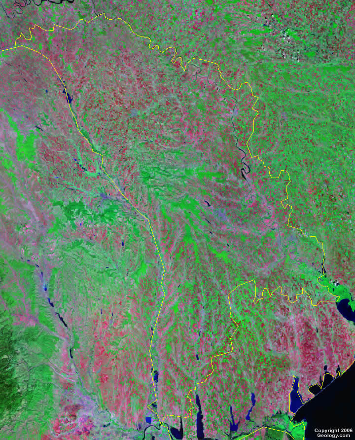
Moldova Map and Satellite Image
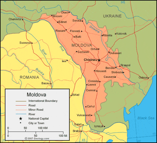
| Moldova is located in eastern Europe. Moldova is bordered by Ukraine to the north and east and Romania to the west. |
ADVERTISEMENT
Moldova Bordering Countries:
Romania, UkraineRegional Maps:
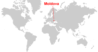
Map of Europe, World MapWhere is Moldova?
Moldova Satellite Image
ADVERTISEMENT

Explore Moldova Using Google Earth:
Google Earth is a free program from Google that allows you to explore satellite images showing the cities and landscapes of Moldova and all of Europe in fantastic detail. It works on your desktop computer, tablet, or mobile phone. The images in many areas are detailed enough that you can see houses, vehicles and even people on a city street. Google Earth is free and easy-to-use.
Moldova on a World Wall Map:
Moldova is one of nearly 200 countries illustrated on our Blue Ocean Laminated Map of the World. This map shows a combination of political and physical features. It includes country boundaries, major cities, major mountains in shaded relief, ocean depth in blue color gradient, along with many other features. This is a great map for students, schools, offices and anywhere that a nice map of the world is needed for education, display or decor.
Moldova On a Large Wall Map of Europe:
If you are interested in Moldova and the geography of Europe our large laminated map of Europe might be just what you need. It is a large political map of Europe that also shows many of the continent's physical features in color or shaded relief. Major lakes, rivers,cities, roads, country boundaries, coastlines and surrounding islands are all shown on the map.Moldova Cities:
Balatina, Balti, Bender, Briceni, Budai, Cahul, Causeni, Chisinau, Cimislia, Colibasi, Comrat, Cornesti, Danu, Dubasari, Edinet, Etulia, Floresti, Glodeni, Hincesti, Largara, Leova, Lipcani, Mingir, Orhei, Otaci, Rezina, Ribnita, Riscani, Slobozia, Soroca, Tiraspol, Tomai and Vulcanesti.Moldova Locations:
Nistru (Dniester) River and Prut River.Moldova Natural Resources:
Moldova has a few mineral resources, some of which are phosphorites, gypsum and limestone. Other natural resources for this country include lignite and arable land.Moldova Natural Hazards:
Moldova has some natural hazards that occur, including landslides. In 1998 alone there were 57 reported landslides for this country.Moldova Environmental Issues:
Some of the environmental issues for Moldova are due to the heavy use of agricultural chemicals (including banned pesticides such as DDT), which have contaminated the soil and groundwater. There is also extensive soil erosion from poor farming methods.
ADVERTISEMENT