Home » World Maps » Africa » Sao Tome and Principe
Sao Tome and Principe Map and Satellite Image
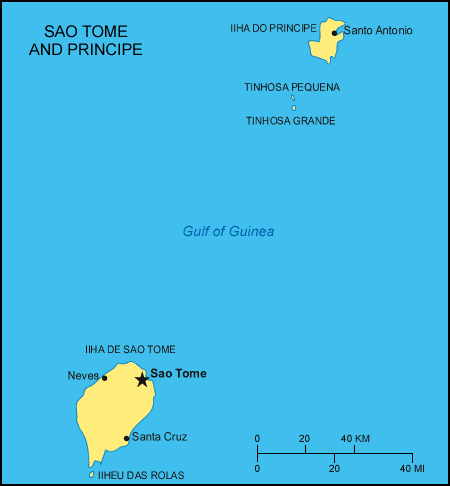
| Sao Tome and Principe are islands located in the Atlantic Ocean, off the western coast of Africa. |
ADVERTISEMENT
Sao Tome and Principe Bordering Countries:
NoneRegional Maps:
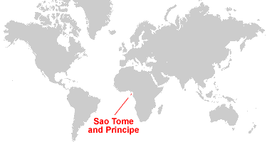
Map of Africa, World MapWhere are Sao Tome and Principe?
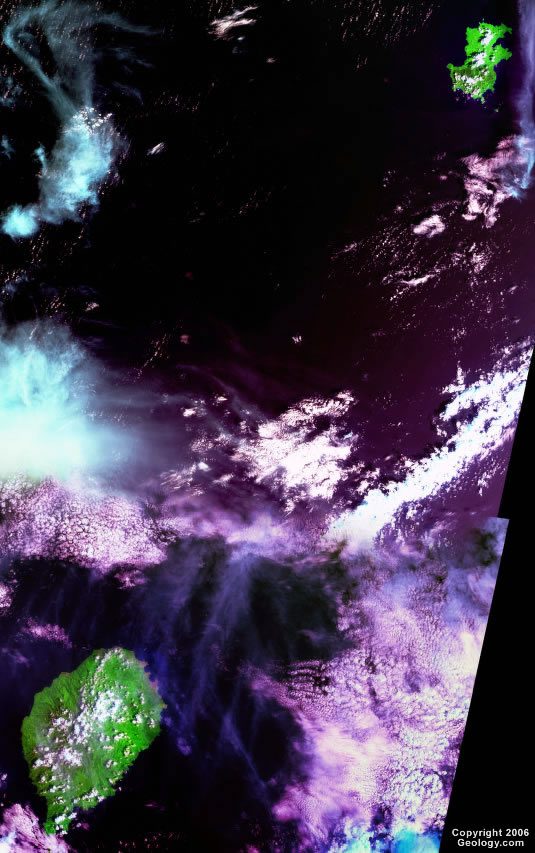
Sao Tome and Principe Satellite Image
ADVERTISEMENT

Explore Sao Tome and Principe Using Google Earth:
Google Earth is a free program from Google that allows you to explore satellite images showing the cities and landscapes of Sao Tome and Principe and all of Africa in fantastic detail. It works on your desktop computer, tablet, or mobile phone. The images in many areas are detailed enough that you can see houses, vehicles and even people on a city street. Google Earth is free and easy-to-use.
Sao Tome and Principe on a World Wall Map:
Sao Tome and Principe is one of nearly 200 countries illustrated on our Blue Ocean Laminated Map of the World. This map shows a combination of political and physical features. It includes country boundaries, major cities, major mountains in shaded relief, ocean depth in blue color gradient, along with many other features. This is a great map for students, schools, offices and anywhere that a nice map of the world is needed for education, display or decor.
Sao Tome and Principe On a Large Wall Map of Africa:
If you are interested in Sao Tome and Principe and the geography of Africa our large laminated map of Africa might be just what you need. It is a large political map of Africa that also shows many of the continent's physical features in color or shaded relief. Major lakes, rivers, cities, roads, country boundaries, coastlines and surrounding islands are all shown on the map.Sao Tome and Principe Cities:
Calixao Grande, Neves, Rio do Ouro, Sant Ana, Santo Antonio, Santo Cruz and Sao Tome.Sao Tome and Principe Locations:
Atlantic Ocean and Gulf of Guinea.Sao Tome and Principe Natural Resources:
Sao Tome and Principe has natural resources including fish and hydropower.Sao Tome and Principe Natural Hazards:
Flooding is a natural hazard for these islands.Sao Tome and Principe Environmental Issues:
The environmental issues for Sao Tome and Principe include deforestation, soil exhaustion, and soil erosion.
ADVERTISEMENT