Home » World Maps » Asia » South Korea
South Korea Map and Satellite Image
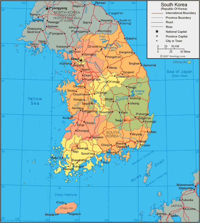
| South Korea is located in eastern Asia. It is bordered by the Yellow Sea to the west, the Sea of Japan (East Sea) to the east, the Korea Strait to the south, and North Korea to the north. |
ADVERTISEMENT
South Korea Bordering Countries:
North KoreaRegional Maps:
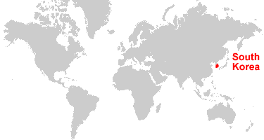
Map of Asia, World MapWhere is South Korea?
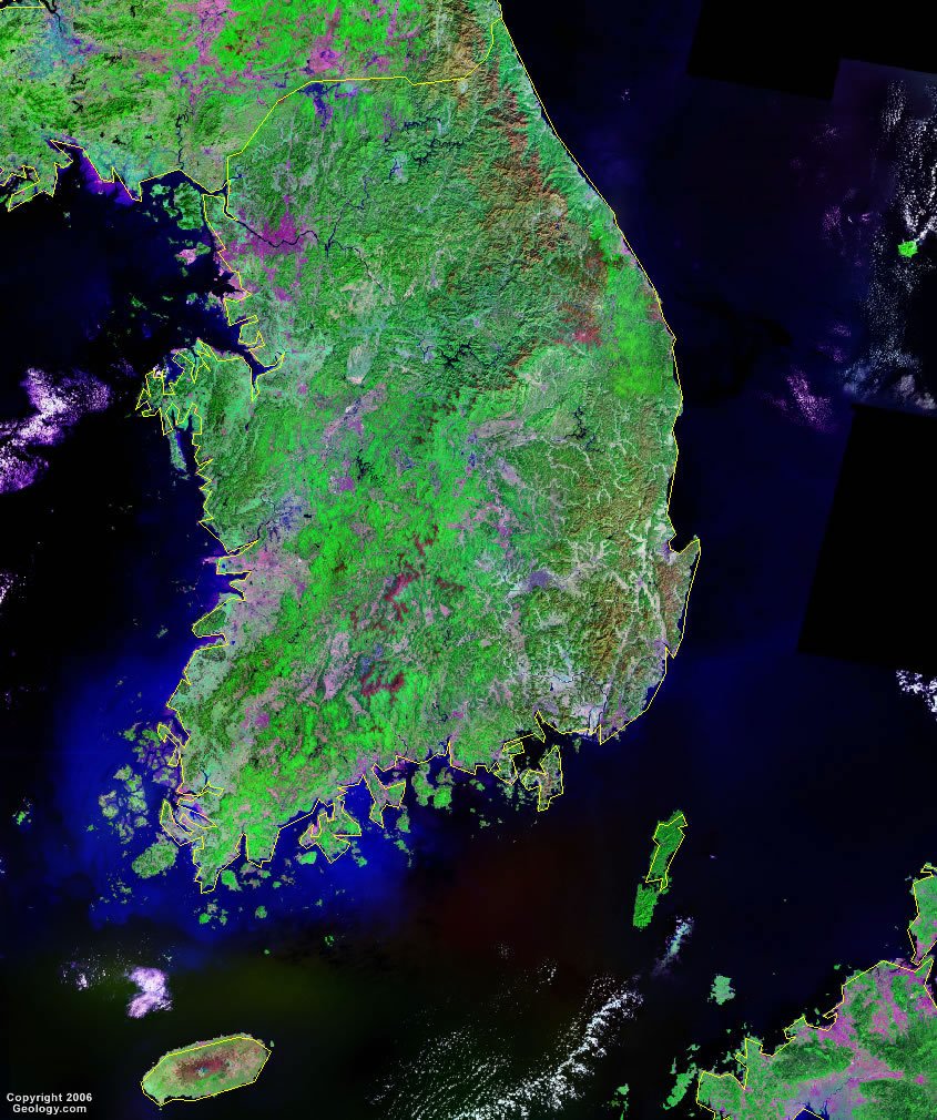
South Korea Satellite Image
ADVERTISEMENT

Explore South Korea Using Google Earth:
Google Earth is a free program from Google that allows you to explore satellite images showing the cities and landscapes of South Korea and all of Asia in fantastic detail. It works on your desktop computer, tablet, or mobile phone. The images in many areas are detailed enough that you can see houses, vehicles and even people on a city street. Google Earth is free and easy-to-use.
South Korea on a World Wall Map:
South Korea is one of nearly 200 countries illustrated on our Blue Ocean Laminated Map of the World. This map shows a combination of political and physical features. It includes country boundaries, major cities, major mountains in shaded relief, ocean depth in blue color gradient, along with many other features. This is a great map for students, schools, offices and anywhere that a nice map of the world is needed for education, display or decor.
South Korea On a Large Wall Map of Asia:
If you are interested in South Korea and the geography of Asia our large laminated map of Asia might be just what you need. It is a large political map of Asia that also shows many of the continent's physical features in color or shaded relief. Major lakes, rivers, cities, roads, country boundaries, coastlines and surrounding islands are all shown on the map.South Korea Cities:
Andong, Anyang, Busan, Chech'on, Chinhae, Chinju, Choch'iwon, Ch'onan, Ch'ongju, Chongup, Chonju, Ch'unch'on, Ch'ungju, Daejeon (Taejon), Eumseong, Gaegu, Gimhae, Gunsan, Gwangju, Haenam, Hallim, Hongch'on, Iksan, Incheon (Inch'on), Jeju (Cheju), Jeonju, Jinju, Kaesong, Kanggyong, Kangjon, Kangnung, Kimhae, Kimje, Kongju, Kosong, Kumi, Kunsan, Kwangju, Kyongju, Masan, Miryang, Mosulp'o, Munsan, Naju, Namwon, Nonsan, Osan, Pohang, Pusan, P'yongt'aek, Samch'ok, Seoul, Sogwip'o, Sokch'o, Sunch'on, Suwon, Tonghae, Uijongbu, Uisong, Ulsan, Wonju, Yeosu, Yesan, Yongju, Yongwol and Yosu.South Korea Locations:
Andong Lake, East China Sea, Han River, Imjin River, Jeju Strait, Korea Bay, Korea Strait, Kum River, Naktong River, Namhan River, Paroho Lake, Puk'an River, Sea of Japan (East Sea), Soyang Lake, Tushima Strait and Yellow Sea.South Korea Natural Resources:
South Korea has some potential fuel resources, such as coal and hydropower. The country's metallic or mineral resources include tungsten, graphite, molybdenum and lead.South Korea Natural Hazards:
The southwest part of South Korea is frequently subject to occurrences of low-level seismic activity. Other natural hazards include the occasional typhoon, which can bring high winds and floods.South Korea Environmental Issues:
South Korea's environmental issues include air pollution in large cities and the resulting acid rain. There is water pollution from the discharge of sewage and industrial effluents. Another problem is the illegal use of drift net fishing in South Korean waters, as these nets can ensnare a wide variety of non-target species and have a detrimental impact on marine environments.
ADVERTISEMENT