Home » World Maps » Asia » Turkmenistan
Turkmenistan Map and Satellite Image
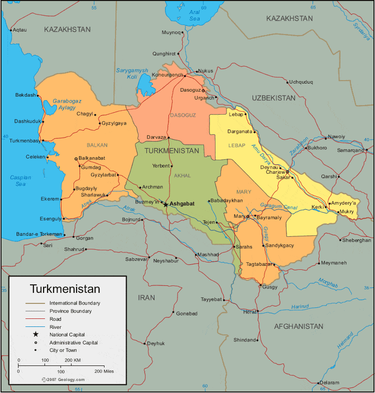
| Turkmenistan is located in central Asia. Turkmenistan is bordered by the Caspian Sea to the west, Kazakhstan and Uzbekistan to the north, and Iran and Afghanistan to the south. |
ADVERTISEMENT
Turkmenistan Bordering Countries:
Afghanistan, Iran, Kazakhstan, UzbekistanRegional Maps:
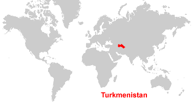
Map of Asia, World MapWhere is Turkmenistan?
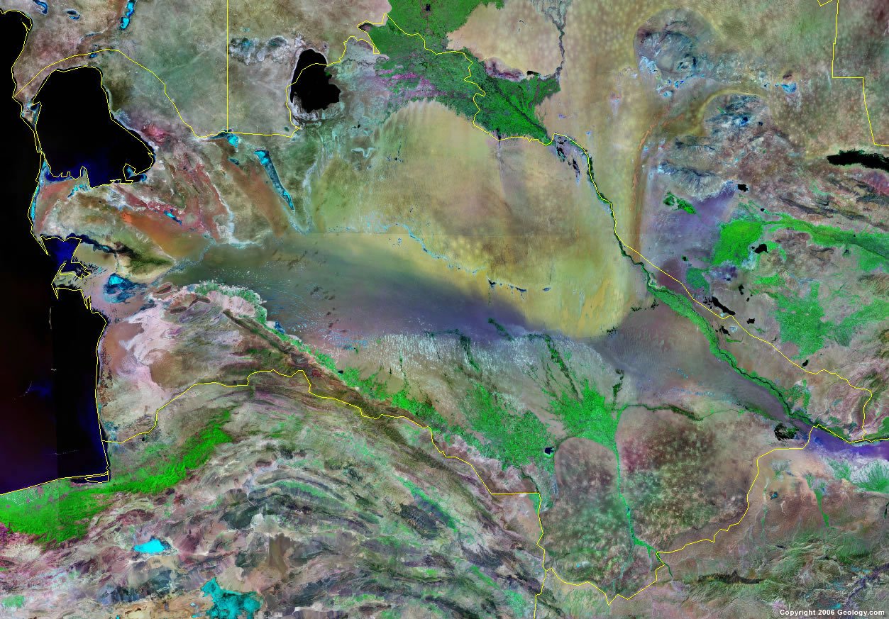
Turkmenistan Satellite Image
ADVERTISEMENT

Explore Turkmenistan Using Google Earth:
Google Earth is a free program from Google that allows you to explore satellite images showing the cities and landscapes of Turkmenistan and all of Asia in fantastic detail. It works on your desktop computer, tablet, or mobile phone. The images in many areas are detailed enough that you can see houses, vehicles and even people on a city street. Google Earth is free and easy-to-use.
Turkmenistan on a World Wall Map:
Turkmenistan is one of nearly 200 countries illustrated on our Blue Ocean Laminated Map of the World. This map shows a combination of political and physical features. It includes country boundaries, major cities, major mountains in shaded relief, ocean depth in blue color gradient, along with many other features. This is a great map for students, schools, offices and anywhere that a nice map of the world is needed for education, display or decor.
Turkmenistan On a Large Wall Map of Asia:
If you are interested in Turkmenistan and the geography of Asia our large laminated map of Asia might be just what you need. It is a large political map of Asia that also shows many of the continent's physical features in color or shaded relief. Major lakes, rivers,cities, roads, country boundaries, coastlines and surrounding islands are all shown on the map.Turkmenistan Cities:
Akdepe, Amydery'a, Archman, Asgabat (Ashgabat), Atamyrat (Kerki), Babadaykhan, Balkanabat (Nebitdag), Bayramaly, Bekdash, Bugdayly, Buzmey'in, Byzylarbat, Celeken, Chagyl, Charjew, Darganata, Darvaza, Dashkuduk, Dasoguz, Deynau, Ekerem, Esenguly, Gumdag, Gusgy, Gyzylgaya, Kaka, Kerki, Koneurgench, Lebap, Mary, Mukry, Murgap, Sakar, Sandykgacy, Sarahs, Sharlawuk, Tagta, Tagtabazar, Tejen, Turkmenabat (Charjew), Turkmenbasy, Yerbent and Yoloten.Turkmenistan Locations:
Amu Darya River, Atrek River, Caspian Sea, Garabogaz Aylagy, Garagum Canal, Gusgy River, Kopetdag Mountains, Sarygamysh Koli, Turkmen Aylagy and Turkmenbasy Aylagy.Turkmenistan Natural Resources:
Turkmenistan has fossil fuel deposits of petroleum of natural gas. Other natural resources for this country include sulfur and salt.Turkmenistan Natural Hazards:
Natural hazards in Turkmenistan include earthquakes, flooding, and mudslides, as well as droughts and dust storms.Turkmenistan Environmental Issues:
Turkmenistan has many environmental issues regarding water. There is pollution of the Caspian Sea. A large share of the Amu Darya has been diverted into irrigation, which is contributing to that river's inability to replenish the Aral Sea. Due to poor irrigation methods, the soil has become water logged and salination has occurred. Pesticides and agricultural chemicals have contaminated the soil and groundwater. In addition, desertification is occurring.
ADVERTISEMENT