Home » US Maps » Maine » Lakes and Rivers
Maine Lakes, Rivers and Water Resources

ADVERTISEMENT
Maine Rivers Shown on the Map: Allagash River, Androscoggin River, Aroostook River, Kennebec River, Mattawamkeag River, Penobscot River, Piscataquis River, Saco River, St. Croix River and St. John River.
Maine Lakes Shown on the Map: Big Lake, Brassua Lake, Caucomgomoc Lake, Chamberlain Lake, Chesuncook Lake, Eagle Lake, Flagstaff Lake, Graham Lake, Grand Lake Seboeis, Great Pond, Long Lake, Moosehead Lake, Mooselookmeguntic Lake, Nicatous Lake, Pemadumcook Lake, Pushaw Lake, Richardson Lakes, Schoodic Lake, Sebago Lake, Sebec Lake, Seboeis Lake, Seboomook Lake, Squapan Lake, Square Lake and West Grand Lake.
| Maine Stream and River Levels |
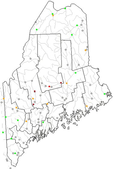 The United States Geological Survey has a number of stream gages located throughout Maine. These estimate stream levels, discharges and record them over time. This data is published on the web and many stations allow users to plot custom graphs. Get updated Maine river and stream levels from USGS here.
| Maine Stream and River Level Alerts |
 The United States Geological Survey has a system that will send you an email message when flood levels are reached on any stream with USGS gaging equipment that you have selected. Sign up here to receive Maine stream and river level alerts.
| Maine Water Publications |
 The United States Geological Survey has a number of publications related to water use and water resources in Maine. Visit the New England Water Science Center here.

| Maine Waterfall: Katahdin Falls |
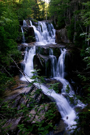 Katahdin Falls is located in Baxter State Park, across from Witherlie Ravine on Mount Katahdin. At about 800 feet high, this tiered waterfall is the tallest in the state of Maine. Image copyright by iStockphoto / KMahelona.
| Maine Drought Map |
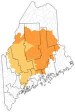 The United States Geological Survey publishes updated drought maps on their website. There you can view a map that shows where below normal 7-day average stream flow conditions were recently recorded. The maps are updated daily. Get a current Maine drought map here.
| Maine Elevation Map |
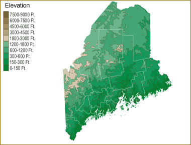 The topography of an area determines the direction of stream flow and often is a primary influence on the geographic distribution of precipitation. View a detailed Maine elevation map.


Find Other Topics on Geology.com:

|

| ||

|

| ||

|

| ||

|

|