Home » World Maps » Asia » Azerbaijan
Azerbaijan Map and Satellite Image
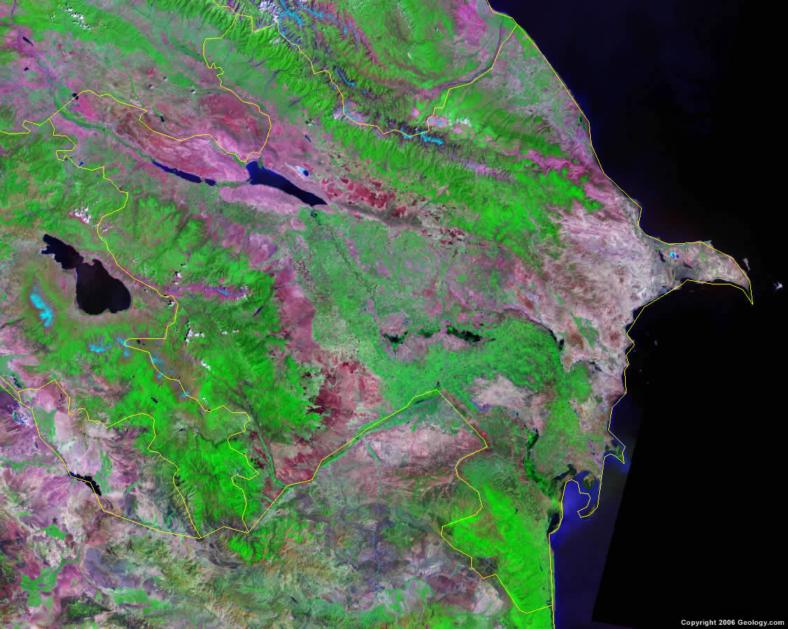
| Azerbaijan is located in southwestern Asia. Azerbaijan is bordered by the Caspian Sea to the east, Russia and Georgia to the north, Armenia and Turkey to the west, and Iran to the south. |
ADVERTISEMENT
Azerbaijan Bordering Countries:
Armenia, Georgia, Iran, Russia, TurkeyRegional Maps:
Map of Asia, World MapWhere is Azerbaijan?
Azerbaijan Satellite Image
ADVERTISEMENT

Explore Azerbaijan Using Google Earth:
Google Earth is a free program from Google that allows you to explore satellite images showing the cities and landscapes of Azerbaijan and all of Asia in fantastic detail. It works on your desktop computer, tablet, or mobile phone. The images in many areas are detailed enough that you can see houses, vehicles and even people on a city street. Google Earth is free and easy-to-use.
Azerbaijan on a World Wall Map:
Azerbaijan is one of nearly 200 countries illustrated on our Blue Ocean Laminated Map of the World. This map shows a combination of political and physical features. It includes country boundaries, major cities, major mountains in shaded relief, ocean depth in blue color gradient, along with many other features. This is a great map for students, schools, offices and anywhere that a nice map of the world is needed for education, display or decor.
Azerbaijan On a Large Wall Map of Asia:
If you are interested in Azerbaijan and the geography of Asia our large laminated map of Asia might be just what you need. It is a large political map of Asia that also shows many of the continent's physical features in color or shaded relief. Major lakes, rivers, cities, roads, country boundaries, coastlines and surrounding islands are all shown on the map.Azerbaijan Cities:
Agdam, Aghjabadi, Aghsu, Agstafa, Alat, Ali Bayramli, Artyom, Astara, Baki (Baku), Barda, Bilasuvar, Fuzuli, Gadabay, Ganca, Goycay, Khanlar, Kurdamir, Lachyn, Lankaran, Lerik, Lykai, Masalli, Mastaga, Mingacevi, Muganly, Naxcivan, Neftcala, Nidzh, Ordubad, Qax, Qazakh, Qazimammad, Quba, Qusar, Saki, Salyan, Sarur, Shakhbuz, Shaumyan, Shemakha, Sumqayit, Tovuz, Xacmaz, Xudat, Yardymly, Yevlax and Zakataly.Azerbaijan Locations:
Aras River, Caspian Sea, Caucasus Mountains, Kur River, Kura Lowlands, Lesser Caucasus, Mingacevir Reservoir, Qizilagac Korfazi and Talish Mountains.Azerbaijan Natural Resources:
Azerbaijan has significant petroleum, natural gas, iron ore, alumina and nonferrous metal resources.Azerbaijan Natural Hazards:
The country of Azerbaijan has natural hazards which include droughts.Azerbaijan Environmental Issues:
Azerbaijan has numerous environmental issues. The local scientists consider the country's Abseron Yasaqligi (Apsheron Peninsula), including the cities of Baku and Sumqayit, and the Caspian Sea to be the most ecologically devastated area in the world. The CIA World Factbook reported this area as having severe soil, air, and water pollution. Azerbaijan's soil pollution (not limited to the peninsula) results from oil spills, the use of DDT as a pesticide, and toxic defoliants used in the production of cotton.
ADVERTISEMENT