Home » World Maps » North America » Caribbean Islands » Barbados
Barbados Map and Satellite Image
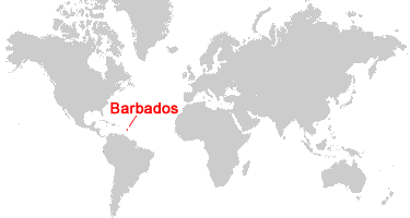
| Barbados is an island situated between the Caribbean Sea and the Atlantic Ocean. It is located in the Lesser Antilles, north of Trinidad and Tobago, and east of St. Vincent and the Grenadines. |
ADVERTISEMENT
Barbados Neighboring Island Groups:
Martinique, St. Lucia, St. Vincent and the Grenadines, Grenada, Trinidad and Tobago.Regional Maps:
Caribbean Islands, North America, World MapWhere is Barbados?
Barbados Satellite Image
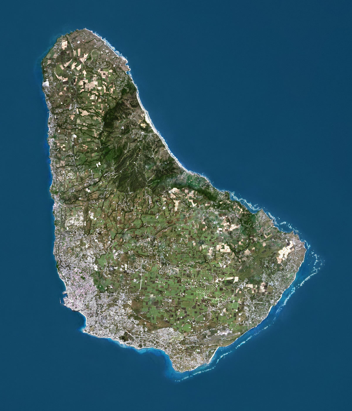
| This satellite image of Barbados was compiled using data from Landsat satellites. Image by Universal Images Group North America LLC / Alamy Stock Photo. Click for a larger view. |
ADVERTISEMENT

Explore Barbados Using Google Earth:
Google Earth is a free program from Google that allows you to explore satellite images showing the cities and landscapes of Barbados and all of the Caribbean in fantastic detail. It works on your desktop computer, tablet, or mobile phone. The images in many areas are detailed enough that you can see houses, vehicles and even people on a city street. Google Earth is free and easy-to-use.
Barbados on a World Wall Map:
Barbados is one of nearly 200 countries illustrated on our Blue Ocean Laminated Map of the World. This map shows a combination of political and physical features. It includes country boundaries, major cities, major mountains in shaded relief, ocean depth in blue color gradient, along with many other features. This is a great map for students, schools, offices and anywhere that a nice map of the world is needed for education, display or decor.
Barbados On a Large Wall Map of North America:
If you are interested in Barbados and the geography of North America, our large laminated map of North America might be just what you need. It is a large political map of North America that also shows many of the continent's physical features in color or shaded relief. Major lakes, rivers, cities, roads, country boundaries, coastlines and surrounding islands are all shown on the map.Barbados Cities, Towns, and Villages:
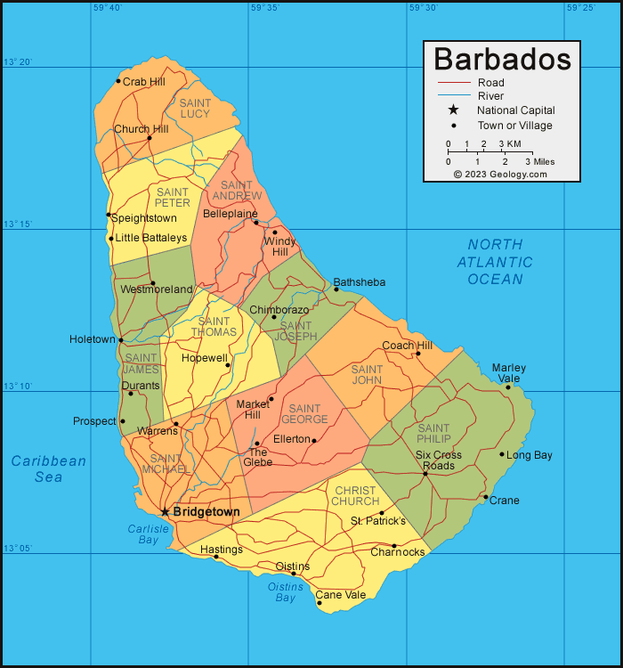
Bathsheba, Belleplaine, Bridgetown, Cane Vale, Charnocks, Chimborazo, Church Hill, Coach Hill, Crab Hill, Crane, Durants, Ellerton, Hastings, Holetown, Hopewell, Little Battaleys, Long Bay, Market Hill, Marley Vale, Oistins, Prospect, Six Cross Roads, Speightstown, St. Patrick's, The Glebe, Warrens, Westmoreland, Windy Hill.Barbados Parishes:
There are 11 parishes in Barbados. They are: Christ Church, Saint Andrew, Saint George, Saint James, Saint John, Saint Joseph, Saint Lucy, Saint Michael, Saint Peter, Saint Philip, and Saint Thomas.Barbados Locations:
Carlisle Bay, Oistins Bay, Caribbean Sea, North Atlantic Ocean.Barbados Natural Resources:
Barbados has natural resources which include petroleum, natural gas, and fish.Barbados Natural Hazards:
Barbados has occasional hurricanes and landslides.Barbados Environmental Issues:
The coastal waters of Barbados have pollution due to waste disposal from ships. Additionally, aquifers can become contaminated from the illegal disposal of solid waste. Soil erosion is also an environmental concern.
ADVERTISEMENT