Home » World Maps » Europe » Bosnia and Herzegovina
Bosnia and Herzegovina Map and Satellite Image
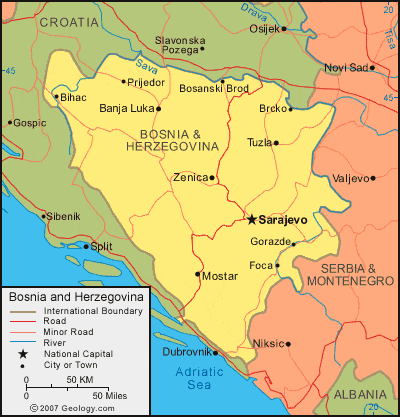
| Bosnia and Herzegovina are located in southeastern Europe. Bosnia and Herzegovina are bordered by Croatia to the north and west, and by Serbia and Montenegro to the east. |
ADVERTISEMENT
Bosnia and Herzegovina Bordering Countries:
Croatia, Montenegro, SerbiaRegional Maps:
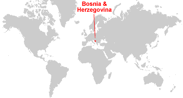
Map of Europe, World MapWhere are Bosnia and Herzegovina?
Bosnia and Herzegovina Satellite Image

ADVERTISEMENT

Explore Bosnia and Herzegovina Using Google Earth:
Google Earth is a free program from Google that allows you to explore satellite images showing the cities and landscapes of Bosnia and Herzegovina and all of Europe in fantastic detail. It works on your desktop computer, tablet, or mobile phone. The images in many areas are detailed enough that you can see houses, vehicles and even people on a city street. Google Earth is free and easy-to-use.
Bosnia and Herzegovina on a World Wall Map:
Bosnia and Herzegovina is one of nearly 200 countries illustrated on our Blue Ocean Laminated Map of the World. This map shows a combination of political and physical features. It includes country boundaries, major cities, major mountains in shaded relief, ocean depth in blue color gradient, along with many other features. This is a great map for students, schools, offices and anywhere that a nice map of the world is needed for education, display or decor.
Bosnia and Herzegovina On a Large Wall Map of Europe:
If you are interested in Bosnia and Herzegovina and the geography of Europe our large laminated map of Europe might be just what you need. It is a large political map of Europe that also shows many of the continent's physical features in color or shaded relief. Major lakes, rivers, cities, roads, country boundaries, coastlines and surrounding islands are all shown on the map.Bosnia and Herzegovina Cities:
Banja Luka, Bihac, Bijeljina, Bosanski Brod, Brcko, Cazin, Derventa, Foca, Gorazde, Gradacac, Gradiska, Mostar, Prijedor, Sanski Most, Sarajevo, Srebrenica, Stijena, Teslic, Tuzla, Zenica and Zvornik.Bosnia and Herzegovina Locations:
Adriatic Sea, Blidinje Jezero, Bosna River, Busko Blato, Deransko Jezero, Dinaric Alps, Drijen Vrelo, Drina River, Jablanicko, Jezero, Neretva River, Sava River and Vrbas River.Bosnia and Herzegovina Natural Resources:
Bosnia and Herzegovina has a diversity of mineral resources which include: iron ore, copper, zinc, cobalt, nickel, gypsum, sand, coal, bauxite, lead, chromite, manganese, clay, salt, forests and hydropower.Bosnia and Herzegovina Natural Hazards:
Bosnia and Herzegovina has natural hazards, which include destructive earthquakes.Bosnia and Herzegovina Environmental Issues:
Bosnia and Herzegovina have a number of environmental issues. These include air pollution from the country's metallurgical plants. The 1992-95 civil strife has caused the destruction of infrastructure and a water shortage. There are limited sites for disposing of urban waste. In addition, the country is encountering deforestation.
ADVERTISEMENT