Home » World Maps » South America » Ecuador » Galapagos Islands
Galapagos Islands Map and Satellite Image

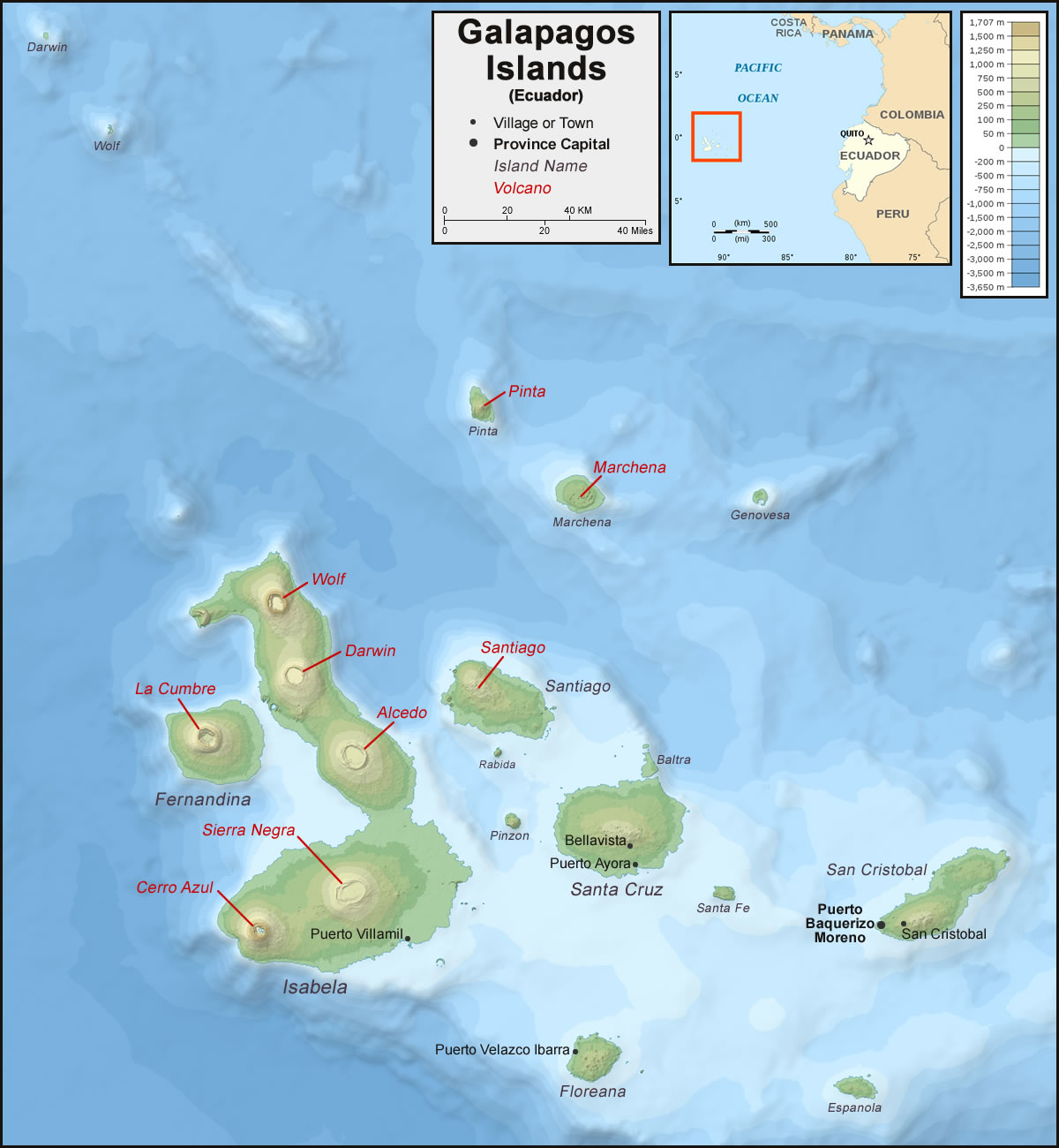
| The Galapagos Islands are a group of volcanic islands located approximately 563 miles (906 km) off the west coast of Ecuador. Of the 22 larger islands, only five are inhabited: Baltra, Floreana, Isabela, San Cristobal, and Santa Cruz. Map by Eric Gaba (Wikimedia Commons user: Sting); bathymetry compiled by William Chadwick, University of Oregon; published here under a Creative Commons Attribution-ShareAlike 3.0 Unported license. Annotations by Geology.com. |
ADVERTISEMENT
Galapagos Islands Bordering Countries:
NoneRegional Maps:
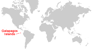
Ecuador, South America, WorldWhere are the Galapagos Islands?

Galapagos Islands Satellite Image

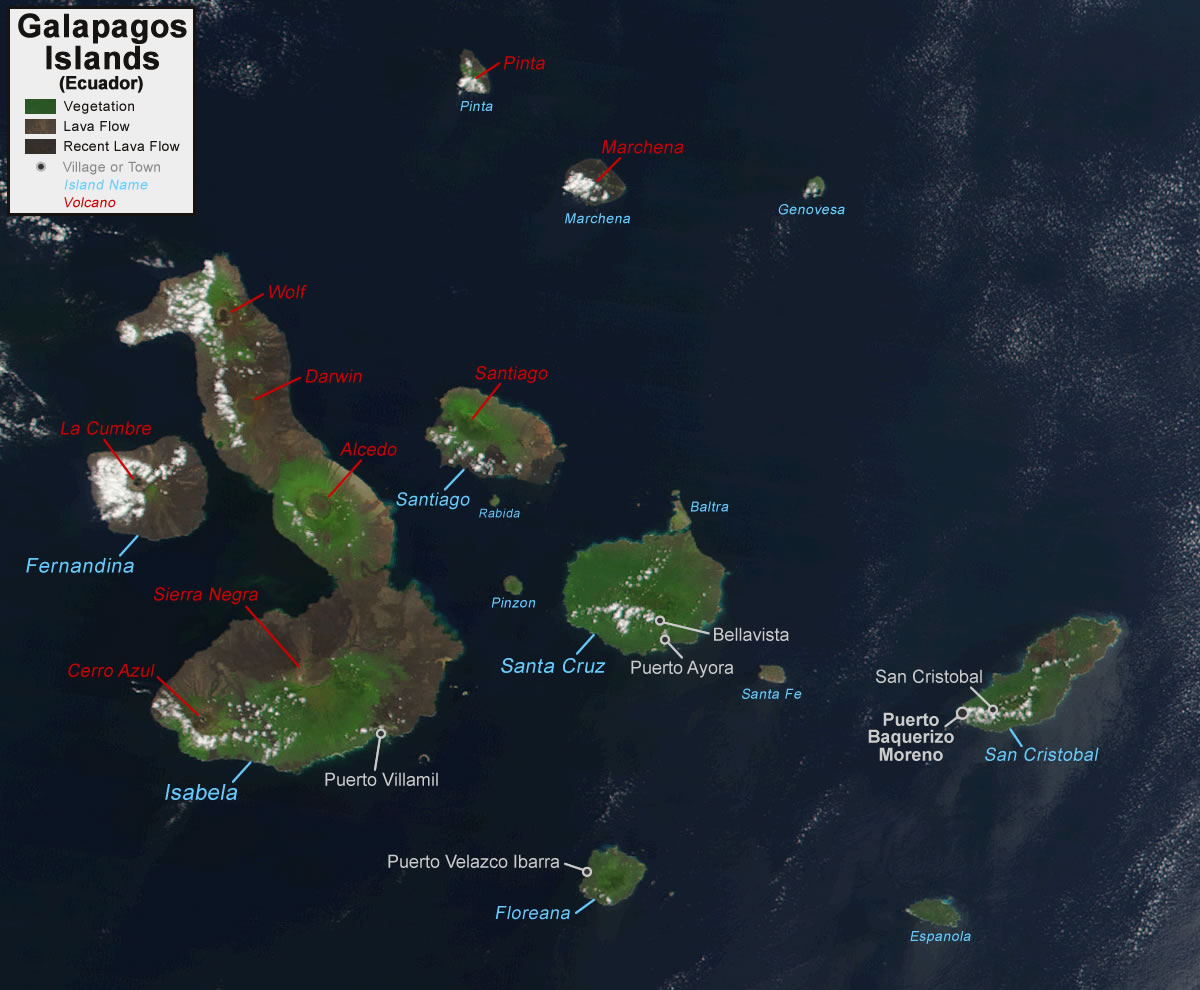
| In this true-color satellite image of the Galapagos Islands, you can see circular volcanic craters and brown lava flows on some of the islands. The nine volcanoes labeled on this image are historically active volcanoes that have erupted in the relatively recent past (since 1800). Satellite image acquired by NASA; annotations by Geology.com. |
ADVERTISEMENT
Explore the Galapagos Islands Using Google Earth:
Google Earth is a free program from Google that allows you to explore satellite images showing the cities and landscapes of the Galapagos Islands, Ecuador, and all of South America in fantastic detail. It works on your desktop computer, tablet, or mobile phone. The images in many areas are detailed enough that you can see houses, vehicles and even people on a city street. Google Earth is free and easy-to-use.Galapagos Islands on a World Wall Map:
The Galapagos Islands are included on our Blue Ocean Laminated Map of the World. This map shows a combination of political and physical features. It includes country boundaries, major cities, major mountains in shaded relief, ocean depth in blue color gradient, along with many other features. This is a great map for students, schools, offices, and anywhere that a nice map of the world is needed for education, display or decor.Galapagos Islands On a Large Wall Map of South America:
If you are interested in the Galapagos Islands and the geography of South America, our large laminated map of South America might be just what you need. It is a large political map of South America that also shows many of the continent's physical features in color or shaded relief. Major lakes, rivers, cities, roads, country boundaries, coastlines and surrounding islands are all shown on the map.Galapagos Islands Settlements:
Bellavista, Puerto Ayora, Puerto Baquerizo Moreno, Puerto Velazco Ibarra, Puerto Villamil, San Cristobal.Galapagos Islands Named Islands:
Baltra, Bartolome, Daphne Major, Darwin, Espanola, Fernandina, Floreana, Genovesa, Isabela, Marchena, Nameless, North Seymour, Pinta, Pinzon, Rabida, Roca Redonda, San Cristobal, Santa Cruz, Santa Fe, Santiago, South Plaza, and Wolf.Galapagos Islands Locations:
Historically active volcanoes on the Galapagos Islands include Wolf, La Cumbre (Fernandina), Sierra Negra, Cerro Azul, Alcedo, Marchena, Pinta, Santiago, and Darwin.Galapagos Islands Natural Resources:
Natural resources include fish and timber. In 1978, UNESCO recognized the Galapagos Islands as a World Heritage Site. There are a number of plant and animal species that are endemic to the islands, including the Galapagos tortoise, Darwin's finches, the Galapagos lava lizard, the flightless cormorant, the world's only marine iguanas, and the Galapagos penguin - the only type of penguin that is found north of the equator.Galapagos Islands Natural Hazards:
The archipelago has a number of historically active volcanoes. Additionally, the islands are vulnerable to El Nino and La Nina cycles.Galapagos Islands Environmental Issues:
Non-native species of plants and animals, introduced to the islands by humans, are a threat to the islands' unique biodiversity. Wildlife is also threatened by the growing number of human inhabitants. Other issues for the Galapagos Islands include illegal fishing, deforestation, and pollution from oil production wastes.ADVERTISEMENT


