Home » World Maps » North America » Mexico
Mexico Map and Satellite Image
Mexico Map of Cities and Roads

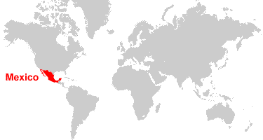
| Mexico is located in North America. Mexico is bordered by the United States to the north, and Belize and Guatemala are to the south. To the west is the Pacific Ocean, and to the east is the recently renamed Gulf of America.
Note: The political maps on this page show the Gulf of America (formerly called the Gulf of Mexico) as depicted on maps published by the CIA World Factbook, which we used as our primary reference for geographic information as recognized by the United States. [Source Map] |
ADVERTISEMENT
Map of Mexico States

Mexico Bordering Countries:
Belize, Guatemala, United States of AmericaRegional Maps:
Map of North America, World MapWhere is Mexico?
Mexico Satellite Image

ADVERTISEMENT

Political Map of Mexico and Central America:
This is a political map of Mexico and Central America which shows the countries of the region along with capital cities, major cities, islands, oceans, seas, and gulfs. The map is a portion of a larger world map created by the Central Intelligence Agency using Robinson Projection. You can also view the full pan-and-zoom CIA World Map as a PDF document.
Explore Mexico Using Google Earth:
Google Earth is a free program from Google that allows you to explore satellite images showing the cities and landscapes of Mexico and all of North America in fantastic detail. It works on your desktop computer, tablet, or mobile phone. The images in many areas are detailed enough that you can see houses, vehicles and even people on a city street. Google Earth is free and easy-to-use.
Mexico on a World Wall Map:
Mexico is one of nearly 200 countries illustrated on our Blue Ocean Laminated Map of the World. This map shows a combination of political and physical features. It includes country boundaries, major cities, major mountains in shaded relief, ocean depth in blue color gradient, along with many other features. This is a great map for students, schools, offices and anywhere that a nice map of the world is needed for education, display or decor.
Mexico On a Large Wall Map of North America:
If you are interested in Mexico and the geography of North America, our large laminated map of North America might be just what you need. It is a large political map of North America that also shows many of the continent's physical features in color or shaded relief. Major lakes, rivers, cities, roads, country boundaries, coastlines and surrounding islands are all shown on the map.Mexico Cities:
Acapulco, Aguascalientes, Cabo San Lucas, Campeche, Cancun, Casas Grandes, Chetumal, Chihuahua, Chilpancingo, Ciudad Acuna, Ciudad del Carmen, Ciudad Juarez, Ciudad Obregon, Ciudad Victoria, Coatzacoalcos, Colima, Cuauhtemoc, Cuernavaca, Culiacan, Delicias, Durango, Ensenada, Guadalajara, Guanajuato, Guaymas, Guerrero Negro, Hermosillo, Hidalgo del Parral, Iguala, Jalapa, Jimenez, La Paz, Lazaro Cardenas, Leon, Loreto, Los Mochis, Manzanillo, Matamoros, Mexicali, Mazatlan, Merida, Mexico City, Monclova, Monterrey, Morelia, Morro Redondo, Nogales, Nuevo Laredo, Oaxaca, Pachuca, Poza Rica, Puebla, Puerto Escondido, Puerto Penasco, Puerto Vallarta, Queretaro, Salina Cruz, Saltillo, San Felipe, San Luis Potosi, San Quintin, Santa Rosalia, Tampico, Tepic, Tlaxcala, Tijuana, Toluca, Torreon, Tuxtla Gutierrez, Veracruz, Villahermosa, and Zacatecas.Mexico States:
Aguascalientes, Baja California, Baja California Sur, Campeche, Chiapas, Chihuahua, Coahuila, Colima, Durango, Guanajuato, Guerrero, Hidalgo, Jalisco, Mexico, Michoacan, Morelos, Nayarit, Nuevo Leon, Oaxaca, Puebla, Queretaro, Quintana Roo, San Luis Potosi, Sinaloa, Sonora, Tabasco, Tamaulipas, Tlaxcala, Veracruz, Yucatan, and Zacatecas. Distrito Federal (the area including and surrounding Mexico City) is a federal district.Mexico Locations:
Bahia Blanco, Bahia de San Jorge, Bahia la Ventana, Bahia Santa Maria, Caribbean Sea, Gulf of America (formerly called the Gulf of Mexico), Gulf of California, Lago Catemaco, Lago de Chapala, Laguna Agua Brava, Laguna de Pueblo Viejo, Laguna de San Andres, Laguna de Tamiahua, Laguna Inferior, Laguna Madre, Pacific Ocean, Presa Alvaro Obregon, Presa de la Angostura, Presa de la Boquilla, Presa Miguel Aleman, Presa Nezahualcoyotl, Rio Balsas, Rio Conchos, Rio Grande and Rio Verde.Mexico Natural Resources:
Mexico has fossil fuel deposits which include petroleum and natural gas. Some of the country's metal resources are copper, gold, lead, silver, and zinc. Timber is also a natural resource for Mexico.Mexico Natural Hazards:
The country of Mexico has volcanic activity and destructive earthquakes which occur in the central and southern parts of the country. Other natural hazards include tsunamis along the Pacific coast, and hurricanes on the Pacific, Gulf, and Caribbean coasts.Mexico Environmental Issues:
Environmental issues for Mexico are numerous. Regarding the land, the issues include: deforestation; widespread erosion; the deterioration of agricultural lands; desertification. In addition, the land in the Valley of Mexico is sinking due to the depletion of groundwater. The country has rural to urban migration. This complicates the serious air and water pollution in the nation's capital and urban centers along the United States-Mexico border. Raw sewage and industrial effluents are polluting the rivers in urban areas. In addition, the natural freshwater resources are scarce and polluted in the north. These resources are also of poor quality or inaccessible in the center and extreme southeast of Mexico. The country has a scarcity of hazardous waste disposal facilities. Note: The government considers the lack of clean water and deforestation national security issues.
ADVERTISEMENT